Earthquake SUNDA STRAIT, INDONESIA
Tue, 21 Mar 2017 13:13:41 GMT
Time8 years ago
Location
-6.0600, 104.3900
Depth
75.0 KM
Event Summary
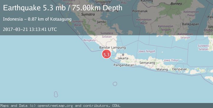
A 5.3 magnitude earthquake struck on SUNDA STRAIT, INDONESIA, at Tue, 21 Mar 2017 13:13:41 GMT. Depth: 75km. Reviewed by EMSC seismologists, this moderate quake occurred at a magnitude type of mb.
Magnitude
5.3
mb
Source
EMSC
Intensity
-
Agency Reports
1 Sources| Source | Magnitude | Depth | Time |
|---|---|---|---|
| EMSCPrimary | 5.3 | 75 km | 8 years ago |
Earthquake Details
AutomaticEvent IDemsc_EMSC_20170321_0000062
Tsunami PotentialNo
Magnitude Typemb
Nearest Places
- Pulau Betuah19.6 km
- Cuku Belimbing24.5 km
- Belimbing24.6 km
- Ujung Saleman25.1 km
- Teluk Belimbing26.4 km
Comments
Join the discussion about this event.
Latest Earthquakes
3.8Mag
Tarapaca, Chile
Time3 minutes ago
Depth93.51 km
SourceVYT (Automatic)
2.5Mag
Ceram Sea
Time5 minutes ago
Depth3.27 km
SourceBMKG
2.1Mag
Halmahera, Indonesia
Time8 minutes ago
Depth4.45 km
SourceBMKG
3.4Mag
Talaud Islands, Indonesia
Time11 minutes ago
Depth98.99 km
SourceBMKG
2.1Mag
Flores Region, Indonesia
Time12 minutes ago
Depth165.90 km
SourceBMKG
Nearby Earthquakes
5.0Mag
SUNDA STRAIT, INDONESIA
Time3 years ago
Depth60.00 km
SourceEMSC (Automatic)
5.2Mag
SUNDA STRAIT, INDONESIA
Time13 years ago
Depth66.00 km
SourceEMSC (Automatic)
5.3Mag
SUNDA STRAIT, INDONESIA
Time18 years ago
Depth10.00 km
SourceEMSC (Automatic)
5.1Mag
SUNDA STRAIT, INDONESIA
Time1 year ago
Depth84.50 km
SourceEMSC (Automatic)
2.7Mag
Sunda Strait, Indonesia
Time3 weeks ago
Depth26.51 km
SourceBMKG (Automatic)