Earthquake NORTH OF HALMAHERA, INDONESIA
Fri, 18 Jan 2019 18:52:04 GMT
Time7 years ago
Location
3.3200, 128.6200
Depth
48.0 KM
Event Summary
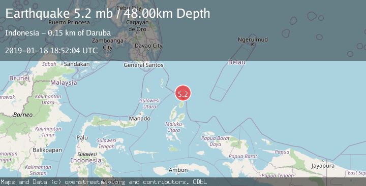
A 5.2 magnitude earthquake struck on NORTH OF HALMAHERA, INDONESIA, at Fri, 18 Jan 2019 18:52:04 GMT. Depth: 48km. Reviewed by EMSC seismologists, this moderate quake occurred at a magnitude type of mb.
Magnitude
5.2
mb
Source
EMSC
Intensity
-
Agency Reports
1 Sources| Source | Magnitude | Depth | Time |
|---|---|---|---|
| EMSCPrimary | 5.2 | 48 km | 7 years ago |
Earthquake Details
AutomaticEvent IDemsc_EMSC_20190118_0000113
Tsunami PotentialNo
Magnitude Typemb
Nearest Places
- Tanjung Sopi75.4 km
- Kakaibabao76.9 km
- Morotai Basin77.5 km
- Papuamalolu78.5 km
- Tanjung Modiu78.8 km
Comments
Join the discussion about this event.
Latest Earthquakes
2.9Mag
Antofagasta, Chile
Time3 minutes ago
Depth109.25 km
SourceVYT (Automatic)
1.9Mag
Andreanof Islands, Aleutian Islands, Alaska
Time5 minutes ago
Depth0.85 km
SourceVYT (Automatic)
0.9Mag
Washington
Time7 minutes ago
Depth0.00 km
SourceVYT (Automatic)
2.7Mag
western Texas
Time10 minutes ago
Depth1.34 km
SourceVYT (Automatic)
2.7Mag
Fox Islands, Aleutian Islands, Alaska
Time13 minutes ago
Depth18.07 km
SourceVYT (Automatic)
Nearby Earthquakes
5.3Mag
NORTH OF HALMAHERA, INDONESIA
Time20 years ago
Depth10.00 km
SourceEMSC (Automatic)
4.0Mag
NORTH OF HALMAHERA, INDONESIA
Time3 years ago
Depth53.00 km
SourceDJA (Automatic)
5.4Mag
NORTH OF HALMAHERA, INDONESIA
Time7 years ago
Depth10.00 km
SourceEMSC (Automatic)
5.0Mag
NORTH OF HALMAHERA, INDONESIA
Time2 years ago
Depth205.70 km
SourceEMSC (Automatic)
5.4Mag
NORTH OF HALMAHERA, INDONESIA
Time10 years ago
Depth50.00 km
SourceEMSC (Automatic)