Earthquake SOUTH OF KERMADEC ISLANDS
Tue, 23 Jul 2019 23:08:52 GMT
Time6 years ago
Location
-33.8700, -179.2100
Depth
10.0 KM
Event Summary
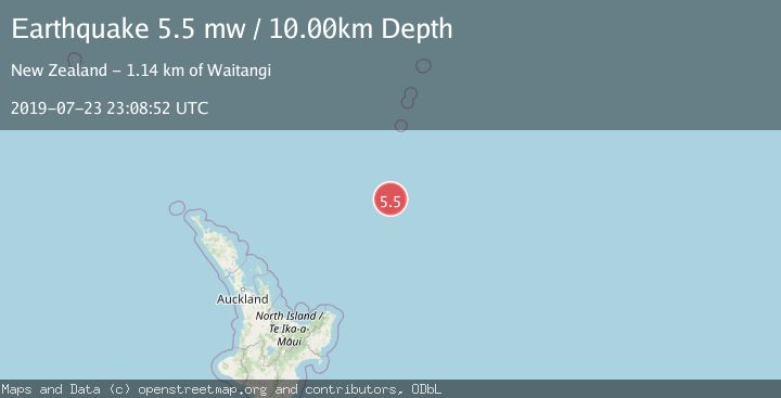
A 5.5 magnitude earthquake struck on SOUTH OF KERMADEC ISLANDS, at Tue, 23 Jul 2019 23:08:52 GMT. Depth: 10km. Reviewed by EMSC seismologists, this moderate quake occurred at a magnitude type of mw.
Magnitude
5.5
mw
Source
EMSC
Intensity
-
Agency Reports
1 Sources| Source | Magnitude | Depth | Time |
|---|---|---|---|
| EMSCPrimary | 5.5 | 10 km | 6 years ago |
Earthquake Details
AutomaticEvent IDemsc_EMSC_20190723_0000124
Tsunami PotentialNo
Magnitude Typemw
Nearest Places
- Ngātoroirangi Seamount93.0 km
- Kuiwai Seamount102.4 km
- Haungaroa Seamount144.4 km
- Kibblewhite Seamount161.6 km
- Star of Bengal Bank161.9 km
Comments
Join the discussion about this event.
Latest Earthquakes
0.7Mag
7 km WNW of Cobb, CA
Time3 minutes ago
Depth1.75 km
SourceUSGS (Automatic)
1.2Mag
9 km N of Banning, CA
Time5 minutes ago
Depth18.03 km
SourceUSGS (Automatic)
2.1Mag
Southern California
Time6 minutes ago
Depth8.54 km
SourceVYT (Automatic)
2.2Mag
Sweden
Time10 minutes ago
Depth0.00 km
SourceVYT (Automatic)
2.6Mag
West Papua Region, Indonesia
Time13 minutes ago
Depth14.47 km
SourceBMKG
Nearby Earthquakes
5.0Mag
SOUTH OF KERMADEC ISLANDS
Time1 year ago
Depth35.00 km
SourceEMSC (Automatic)
5.4Mag
SOUTH OF KERMADEC ISLANDS
Time10 months ago
Depth30.00 km
SourceEMSC (Automatic)
5.3Mag
SOUTH OF KERMADEC ISLANDS
Time4 years ago
Depth41.00 km
SourceEMSC (Automatic)
5.6Mag
SOUTH OF KERMADEC ISLANDS
Time18 years ago
Depth2.00 km
SourceEMSC (Automatic)
5.5Mag
SOUTH OF KERMADEC ISLANDS
Time18 years ago
Depth33.00 km
SourceEMSC (Automatic)