Earthquake West Papua Region, Indonesia
Fri, 20 Feb 2026 07:56:43 GMT
Time1 hour ago
Location
-3.8335, 135.3586
Depth
14.5 KM
Event Summary
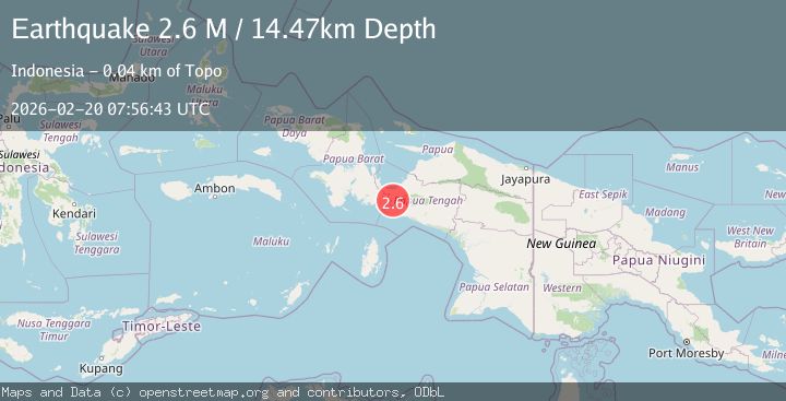
A 2.6 magnitude earthquake struck on West Papua Region, Indonesia, at Fri, 20 Feb 2026 07:56:43 GMT. Depth: 14.470746km. Reviewed by BMKG seismologists, this minor quake occurred at a magnitude type of M.
Magnitude
2.6
M
Source
BMKG
Intensity
-
Agency Reports
1 Sources| Source | Magnitude | Depth | Time |
|---|---|---|---|
| BMKGPrimary | 2.6 | 14 km | 1 hour ago |
Earthquake Details
ManualEvent IDbmg2026dnyw
Tsunami PotentialNo
Magnitude TypeM
Nearest Places
- Kampung Yegeugi4.1 km
- Distrik Menou5.4 km
- Kampung Ideduwa6.8 km
- Sungai Memi11.3 km
- Jabi12.8 km
Comments
Join the discussion about this event.
Latest Earthquakes
2.2Mag
Sweden
Time1 hour ago
Depth0.00 km
SourceVYT (Automatic)
1.9Mag
5 km SSE of Pāhala, Hawaii
Time1 hour ago
Depth32.73 km
SourceUSGS (Automatic)
1.0Mag
11 km NE of Yucaipa, CA
Time1 hour ago
Depth7.69 km
SourceUSGS (Automatic)
2.3Mag
Timor Region
Time1 hour ago
Depth78.78 km
SourceBMKG
2.9Mag
Timor Sea
Time1 hour ago
Depth348.75 km
SourceVYT (Automatic)
Nearby Earthquakes
4.0Mag
PAPUA, INDONESIA
Time2 years ago
Depth10.00 km
SourceBMKG (Automatic)
3.0Mag
PAPUA, INDONESIA
Time7 months ago
Depth12.00 km
SourceBMKG (Automatic)
3.0Mag
West Papua Region, Indonesia
Time2 days ago
Depth10.00 km
SourceBMKG
3.0Mag
PAPUA, INDONESIA
Time5 months ago
Depth10.00 km
SourceBMKG (Automatic)
2.5Mag
PAPUA, INDONESIA
Time1 month ago
Depth12.00 km
SourceBMKG (Automatic)