Earthquake BANDA SEA
Thu, 02 Apr 2020 21:42:41 GMT
Time5 years ago
Location
-6.9500, 126.5800
Depth
412.0 KM
Event Summary
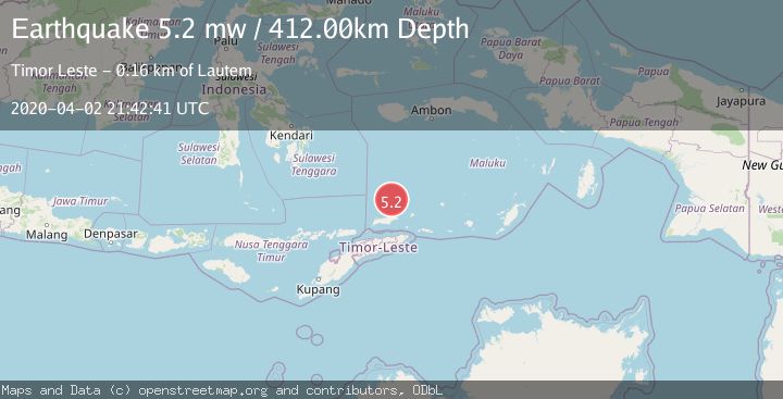
A 5.2 magnitude earthquake struck on BANDA SEA, at Thu, 02 Apr 2020 21:42:41 GMT. Depth: 412km. Reviewed by EMSC seismologists, this moderate quake occurred at a magnitude type of mw.
Magnitude
5.2
mw
Source
EMSC
Intensity
-
Agency Reports
1 Sources| Source | Magnitude | Depth | Time |
|---|---|---|---|
| EMSCPrimary | 5.2 | 412 km | 5 years ago |
Earthquake Details
AutomaticEvent IDemsc_EMSC_20200402_0000216
Tsunami PotentialNo
Magnitude Typemw
Nearest Places
- Pulau Gunungapi35.8 km
- Tanjung Tutunnila67.7 km
- Tanjung Tutuntujau68.6 km
- Meta Gering69.5 km
- Wesiri70.7 km
Comments
Join the discussion about this event.
Latest Earthquakes
2.4Mag
West Papua Region, Indonesia
Time9 minutes ago
Depth10.00 km
SourceBMKG
3.3Mag
Talaud Islands, Indonesia
Time10 minutes ago
Depth10.00 km
SourceBMKG
1.1Mag
4 km NW of The Geysers, CA
Time11 minutes ago
Depth3.39 km
SourceUSGS (Automatic)
1.0Mag
33 km WSW of Ackerly, Texas
Time11 minutes ago
Depth4.44 km
SourceUSGS (Automatic)
2.8Mag
Antofagasta, Chile
Time15 minutes ago
Depth0.00 km
SourceVYT (Automatic)
Nearby Earthquakes
4.8Mag
Banda Sea
Time0 months ago
Depth394.10 km
SourceBMKG (Automatic)
4.0Mag
BANDA SEA
Time3 years ago
Depth398.00 km
SourceNEIC (Automatic)
5.1Mag
KEPULAUAN BARAT DAYA, INDONESIA
Time9 years ago
Depth404.00 km
SourceEMSC (Automatic)
5.2Mag
KEPULAUAN BARAT DAYA, INDONESIA
Time5 years ago
Depth372.00 km
SourceEMSC (Automatic)
4.0Mag
KEPULAUAN BARAT DAYA, INDONESIA
Time1 year ago
Depth307.00 km
SourceBMKG (Automatic)