Earthquake MYANMAR-INDIA BORDER REGION
Sun, 21 Jun 2020 10:46:23 GMT
Time5 years ago
Location
23.9000, 93.1400
Depth
39.0 KM
Event Summary
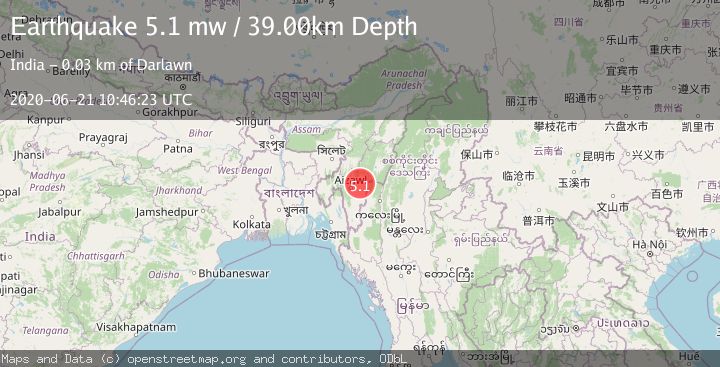
A 5.1 magnitude earthquake struck on MYANMAR-INDIA BORDER REGION, at Sun, 21 Jun 2020 10:46:23 GMT. Depth: 39km. Reviewed by EMSC seismologists, this moderate quake occurred at a magnitude type of mw.
Magnitude
5.1
mw
Source
EMSC
Intensity
-
Agency Reports
1 Sources| Source | Magnitude | Depth | Time |
|---|---|---|---|
| EMSCPrimary | 5.1 | 39 km | 5 years ago |
Earthquake Details
AutomaticEvent IDemsc_EMSC_20200621_0000084
Tsunami PotentialNo
Magnitude Typemw
Nearest Places
- 3.5 km
- 7.4 km
- 7.6 km
- 10.8 km
- 11.3 km
Comments
Join the discussion about this event.
Latest Earthquakes
1.5Mag
Western Australia
Time3 minutes ago
Depth6.71 km
SourceVYT (Automatic)
1.6Mag
26 km W of Central, Alaska
Time4 minutes ago
Depth6.70 km
SourceUSGS (Automatic)
2.0Mag
Poland
Time6 minutes ago
Depth5.37 km
SourceVYT (Automatic)
1.8Mag
offshore Atacama, Chile
Time6 minutes ago
Depth23.68 km
SourceVYT (Automatic)
1.7Mag
Southern Alaska
Time15 minutes ago
Depth0.00 km
SourceVYT (Automatic)
Nearby Earthquakes
2.8Mag
MANIPUR, INDIA REGION
Time3 weeks ago
Depth36.00 km
SourceNDI (Automatic)
3.3Mag
MYANMAR-INDIA BORDER REGION
Time1 month ago
Depth45.00 km
SourceNDI (Automatic)
5.2Mag
MYANMAR-INDIA BORDER REGION
Time7 years ago
Depth52.00 km
SourceEMSC (Automatic)
3.0Mag
MANIPUR, INDIA REGION
Time8 years ago
Depth10.00 km
SourceNDI (Automatic)
5.0Mag
MANIPUR, INDIA REGION
Time9 years ago
Depth54.00 km
SourceEMSC (Automatic)