Earthquake PHILIPPINE ISLANDS REGION
Thu, 01 Jan 2026 02:56:22 GMT
Time1 month ago
Location
5.0252, 127.5372
Depth
118.9 KM
Event Summary
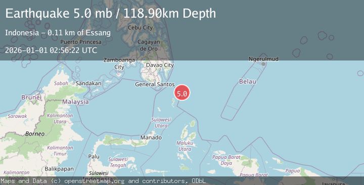
A 5.0 magnitude earthquake struck on PHILIPPINE ISLANDS REGION, at Thu, 01 Jan 2026 02:56:22 GMT. Depth: 118.9km. Reviewed by EMSC seismologists, this moderate quake occurred at a magnitude type of mb.
Magnitude
5.0
mb
Source
EMSC
Intensity
-
Agency Reports
1 Sources| Source | Magnitude | Depth | Time |
|---|---|---|---|
| EMSCPrimary | 5.0 | 119 km | 1 month ago |
Earthquake Details
AutomaticEvent IDemsc_EMSC_20260101_0000039
Tsunami PotentialNo
Magnitude Typemb
Nearest Places
- Desa Marampit Timur53.2 km
- Desa Marampit54.0 km
- Kecamatan Nanusa54.5 km
- Pulau Marampit54.6 km
- Desa Dampulis55.0 km
Comments
Join the discussion about this event.
Latest Earthquakes
1.4Mag
Southern Alaska
Time4 minutes ago
Depth0.00 km
SourceVYT (Automatic)
2.6Mag
West Papua, Indonesia
Time6 minutes ago
Depth10.00 km
SourceBMKG
1.7Mag
Unimak Island region, Alaska
Time7 minutes ago
Depth0.00 km
SourceVYT (Automatic)
1.1Mag
British Columbia, Canada
Time8 minutes ago
Depth6.35 km
SourceVYT (Automatic)
0.9Mag
5 km W of Cobb, CA
Time8 minutes ago
Depth11.30 km
SourceUSGS (Automatic)
Nearby Earthquakes
7.0Mag
PHILIPPINE ISLANDS REGION
Time5 years ago
Depth92.00 km
SourceEMSC (Automatic)
5.2Mag
KEPULAUAN TALAUD, INDONESIA
Time11 years ago
Depth128.00 km
SourceEMSC (Automatic)
3.0Mag
PHILIPPINE ISLANDS REGION
Time8 months ago
Depth11.00 km
SourcePIVS (Automatic)
3.0Mag
KEPULAUAN TALAUD, INDONESIA
Time5 years ago
Depth119.00 km
SourcePIVS (Automatic)
3.0Mag
KEPULAUAN TALAUD, INDONESIA
Time7 months ago
Depth71.00 km
SourcePIVS (Automatic)