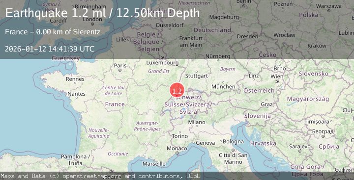
Earthquake FRANCE-GERMANY BORDER REGION
Mon, 12 Jan 2026 14:41:39 GMT
Time1 month ago
Location
47.6818, 7.4693
Depth
12.5 KM
Event Summary
A 1.2 magnitude earthquake struck on FRANCE-GERMANY BORDER REGION, at Mon, 12 Jan 2026 14:41:39 GMT. Depth: 12.5km. Reviewed by EMSC seismologists, this minor quake occurred at a magnitude type of ml.
Magnitude
1.2
ml
Source
EMSC
Intensity
-
Agency Reports
1 Sources| Source | Magnitude | Depth | Time |
|---|---|---|---|
| EMSCPrimary | 1.2 | 13 km | 1 month ago |
Earthquake Details
AutomaticEvent IDemsc_EMSC_20260112_0000373
Tsunami PotentialNo
Magnitude Typeml
Nearest Places
- Bureau de Poste de Kembs2.5 km
- Kembs2.7 km
- Kembs2.7 km
- Sierentz2.9 km
- Sierentz Railway Station3.0 km
Comments
Join the discussion about this event.
Latest Earthquakes
0.8Mag
8 km NW of The Geysers, CA
Time4 minutes ago
Depth1.52 km
SourceUSGS (Automatic)
3.9Mag
Coquimbo, Chile
Time8 minutes ago
Depth26.98 km
SourceVYT (Automatic)
2.7Mag
near the coast of Tarapaca, Chile
Time16 minutes ago
Depth56.52 km
SourceVYT (Automatic)
3.8Mag
Molucca Sea
Time17 minutes ago
Depth47.00 km
SourceVYT (Automatic)
1.7Mag
4 km SE of San Ramon, CA
Time18 minutes ago
Depth7.10 km
SourceUSGS (Automatic)
Nearby Earthquakes
2.4Mag
FRANCE-GERMANY BORDER REGION
Time1 month ago
Depth13.00 km
SourceEMSC (Automatic)
3.0Mag
FRANCE-GERMANY BORDER REGION
Time3 years ago
Depth14.00 km
SourceEMSC (Automatic)
0.6Mag
SWITZERLAND
Time3 weeks ago
Depth12.00 km
SourceLED (Automatic)
0.8Mag
FRANCE-GERMANY BORDER REGION
Time3 weeks ago
Depth16.00 km
SourceEMSC (Automatic)
0.4Mag
FRANCE-GERMANY BORDER REGION
Time2 weeks ago
Depth16.00 km
SourceLED (Automatic)