Earthquake KEPULAUAN BARAT DAYA, INDONESIA
Mon, 19 Jan 2026 22:15:55 GMT
Time1 month ago
Location
-7.2791, 128.4295
Depth
180.0 KM
Event Summary
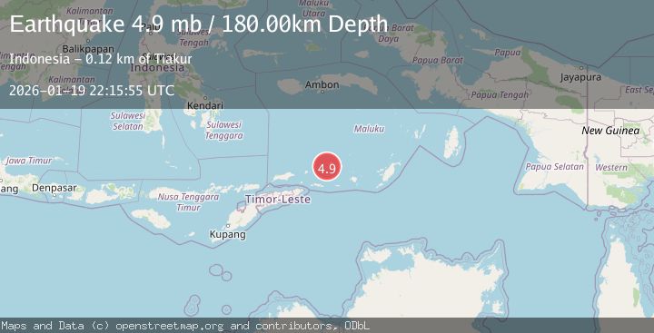
A 4.9 magnitude earthquake struck on KEPULAUAN BARAT DAYA, INDONESIA, at Mon, 19 Jan 2026 22:15:55 GMT. Depth: 180km. Reviewed by EMSC seismologists, this light quake occurred at a magnitude type of mb.
Magnitude
4.9
mb
Source
EMSC
Intensity
-
Agency Reports
1 Sources| Source | Magnitude | Depth | Time |
|---|---|---|---|
| EMSCPrimary | 4.9 | 180 km | 1 month ago |
Earthquake Details
AutomaticEvent IDemsc_EMSC_20260119_0000307
Tsunami PotentialNo
Magnitude Typemb
Nearest Places
- Pulau Musleur7.4 km
- Pulau Terbang Utara14.8 km
- Pulau Terbang Selatan17.5 km
- Tanjung Tutitlakani18.8 km
- Desa Batu Merah20.9 km
Comments
Join the discussion about this event.
Latest Earthquakes
4.5Mag
North of Halmahera, Indonesia
Time28 minutes ago
Depth10.00 km
SourceBMKG
3.1Mag
Bali Region, Indonesia
Time34 minutes ago
Depth19.14 km
SourceBMKG
2.7Mag
Coquimbo, Chile
Time35 minutes ago
Depth14.16 km
SourceVYT (Automatic)
1.7Mag
Southeastern Alaska
Time37 minutes ago
Depth5.98 km
SourceVYT (Automatic)
2.1Mag
Tarapaca, Chile
Time38 minutes ago
Depth110.35 km
SourceVYT (Automatic)
Nearby Earthquakes
4.0Mag
KEPULAUAN BARAT DAYA, INDONESIA
Time9 months ago
Depth152.80 km
SourceNEIC (Automatic)
5.6Mag
KEPULAUAN BARAT DAYA, INDONESIA
Time18 years ago
Depth114.00 km
SourceEMSC (Automatic)
4.0Mag
KEPULAUAN BARAT DAYA, INDONESIA
Time4 years ago
Depth156.00 km
SourceNEIC (Automatic)
5.2Mag
KEPULAUAN BARAT DAYA, INDONESIA
Time5 years ago
Depth141.00 km
SourceEMSC (Automatic)
5.3Mag
KEPULAUAN BARAT DAYA, INDONESIA
Time20 years ago
Depth180.00 km
SourceEMSC (Automatic)