Earthquake NEAR N COAST OF PAPUA, INDONESIA
Sat, 07 Feb 2009 21:56:07 GMT
Time17 years ago
Location
-0.5700, 132.8900
Depth
26.0 KM
Event Summary
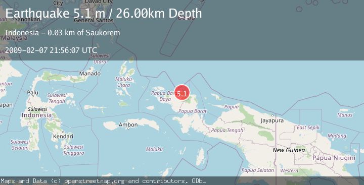
A 5.1 magnitude earthquake struck on NEAR N COAST OF PAPUA, INDONESIA, at Sat, 07 Feb 2009 21:56:07 GMT. Depth: 26km. Reviewed by GFZ seismologists, this moderate quake occurred at a magnitude type of m.
Magnitude
5.1
m
Source
GFZ
Intensity
-
Agency Reports
1 Sources| Source | Magnitude | Depth | Time |
|---|---|---|---|
| GFZPrimary | 5.1 | 26 km | 17 years ago |
Earthquake Details
AutomaticEvent IDemsc_GFZ_20090207_0000073
Tsunami PotentialNo
Magnitude Typem
Nearest Places
- Kampung Waibem0.2 km
- Kampung Weprari4.7 km
- Maurepi5.4 km
- Kampung Imbuan6.1 km
- Warbenai6.7 km
Comments
Join the discussion about this event.
Latest Earthquakes
2.8Mag
Sulawesi, Indonesia
Time3 minutes ago
Depth21.08 km
SourceBMKG
2.1Mag
WESTERN TURKEY
Time7 minutes ago
Depth12.30 km
SourceKOERI (Automatic)
2.2Mag
Alaska Peninsula
Time7 minutes ago
Depth57.74 km
SourceVYT (Automatic)
3.8Mag
WESTERN TURKEY
Time10 minutes ago
Depth13.30 km
SourceKOERI (Automatic)
1.6Mag
27 km ESE of Balmorhea, Texas
Time10 minutes ago
Depth3.56 km
SourceUSGS (Automatic)
Nearby Earthquakes
2.1Mag
West Papua Region, Indonesia
Time3 weeks ago
Depth10.00 km
SourceBMKG (Automatic)
5.0Mag
NEAR N COAST OF PAPUA, INDONESIA
Time17 years ago
Depth40.00 km
SourceEMSC (Automatic)
6.0Mag
NEAR N COAST OF PAPUA, INDONESIA
Time16 years ago
Depth40.00 km
SourceEMSC (Automatic)
5.3Mag
NEAR N COAST OF PAPUA, INDONESIA
Time17 years ago
Depth10.00 km
SourceEMSC (Automatic)
2.3Mag
West Papua Region, Indonesia
Time5 days ago
Depth10.00 km
SourceBMKG