Earthquake SOUTH OF SUMBAWA, INDONESIA
Wed, 16 Mar 2016 13:11:27 GMT
Time9 years ago
Location
-11.9000, 118.4000
Depth
10.0 KM
Event Summary
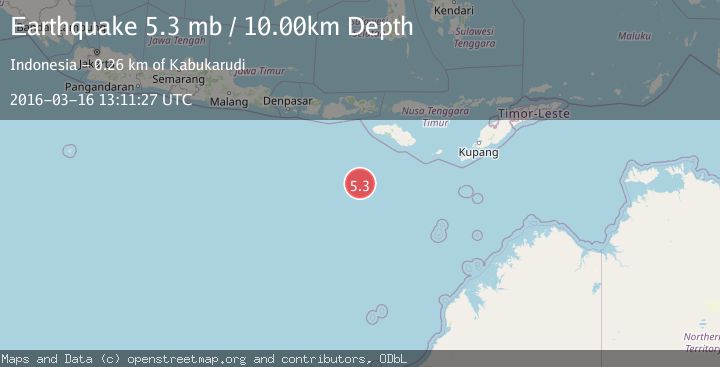
A 5.3 magnitude earthquake struck on SOUTH OF SUMBAWA, INDONESIA, at Wed, 16 Mar 2016 13:11:27 GMT. Depth: 10km. Reviewed by GFZ seismologists, this moderate quake occurred at a magnitude type of mb.
Magnitude
5.3
mb
Source
GFZ
Intensity
-
Agency Reports
1 Sources| Source | Magnitude | Depth | Time |
|---|---|---|---|
| GFZPrimary | 5.3 | 10 km | 9 years ago |
Earthquake Details
AutomaticEvent IDemsc_GFZ_20160316_0000048
Tsunami PotentialNo
Magnitude Typemb
Nearest Places
- Corona Bank60.2 km
- Watu Kalode253.7 km
- Tanjung Mambang253.9 km
- Tanjung Toroha254.0 km
- Tanjung Matogola254.1 km
Comments
Join the discussion about this event.
Latest Earthquakes
0.7Mag
6 km WNW of Cobb, CA
Time10 hours ago
Depth-0.59 km
SourceUSGS (Automatic)
0.7Mag
Southern Alaska
Time10 hours ago
Depth0.12 km
SourceVYT (Automatic)
2.1Mag
Sumbawa Region, Indonesia
Time10 hours ago
Depth21.86 km
SourceBMKG
4.0Mag
northwest of Australia
Time10 hours ago
Depth91.80 km
SourceVYT (Automatic)
1.8Mag
Tarapaca, Chile
Time10 hours ago
Depth16.60 km
SourceVYT (Automatic)
Nearby Earthquakes
4.0Mag
SOUTH OF SUMBAWA, INDONESIA
Time4 years ago
Depth10.00 km
SourceDJA (Automatic)
3.6Mag
SOUTH OF SUMBAWA, INDONESIA
Time1 month ago
Depth10.00 km
SourceBMKG (Automatic)
5.1Mag
SOUTH OF SUMBAWA, INDONESIA
Time18 years ago
Depth50.00 km
SourceGFZ (Automatic)
4.0Mag
SOUTH OF SUMBAWA, INDONESIA
Time7 years ago
Depth10.00 km
SourceDJA (Automatic)
5.3Mag
south of Sumbawa, Indonesia
Time2 days ago
Depth10.00 km
SourceVYT (Automatic)