Earthquake KERMADEC ISLANDS REGION
Wed, 18 Oct 2017 14:44:46 GMT
Time8 years ago
Location
-30.7700, 179.4600
Depth
173.0 KM
Event Summary
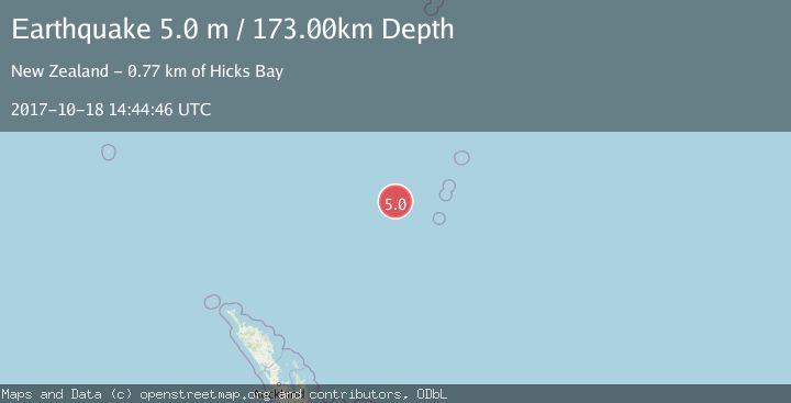
A 5.0 magnitude earthquake struck on KERMADEC ISLANDS REGION, at Wed, 18 Oct 2017 14:44:46 GMT. Depth: 173km. Reviewed by GNS seismologists, this moderate quake occurred at a magnitude type of m.
Magnitude
5.0
m
Source
GNS
Intensity
-
Agency Reports
1 Sources| Source | Magnitude | Depth | Time |
|---|---|---|---|
| GNSPrimary | 5.0 | 173 km | 8 years ago |
Earthquake Details
AutomaticEvent IDemsc_GNS_20171018_0000112
Tsunami PotentialNo
Magnitude Typem
Nearest Places
- Colville Ridge100.1 km
- Annexation Point114.3 km
- Havre Trough128.0 km
- Havre Seamount146.7 km
- Havre Rock160.2 km
Comments
Join the discussion about this event.
Latest Earthquakes
0.4Mag
31 km NW of Toyah, Texas
Time4 minutes ago
Depth4.11 km
SourceUSGS (Automatic)
2.5Mag
Tarapaca, Chile
Time10 minutes ago
Depth0.12 km
SourceVYT (Automatic)
2.3Mag
West Papua Region, Indonesia
Time15 minutes ago
Depth10.00 km
SourceBMKG
2.3Mag
FRANCE
Time17 minutes ago
Depth5.00 km
SourceReNaSS (Automatic)
2.6Mag
Tarapaca, Chile
Time21 minutes ago
Depth106.08 km
SourceVYT (Automatic)
Nearby Earthquakes
5.1Mag
KERMADEC ISLANDS REGION
Time10 years ago
Depth326.00 km
SourceGNS (Automatic)
3.1Mag
KERMADEC ISLANDS REGION
Time1 month ago
Depth600.00 km
SourceGNS (Automatic)
5.0Mag
KERMADEC ISLANDS REGION
Time10 years ago
Depth166.00 km
SourceGNS (Automatic)
6.2Mag
KERMADEC ISLANDS REGION
Time18 years ago
Depth400.00 km
SourceEMSC (Automatic)
4.0Mag
KERMADEC ISLANDS REGION
Time7 years ago
Depth433.00 km
SourceNEIC (Automatic)