Earthquake KERMADEC ISLANDS REGION
Mon, 14 May 2018 13:19:21 GMT
Time7 years ago
Location
-31.2500, 179.6300
Depth
433.0 KM
Event Summary
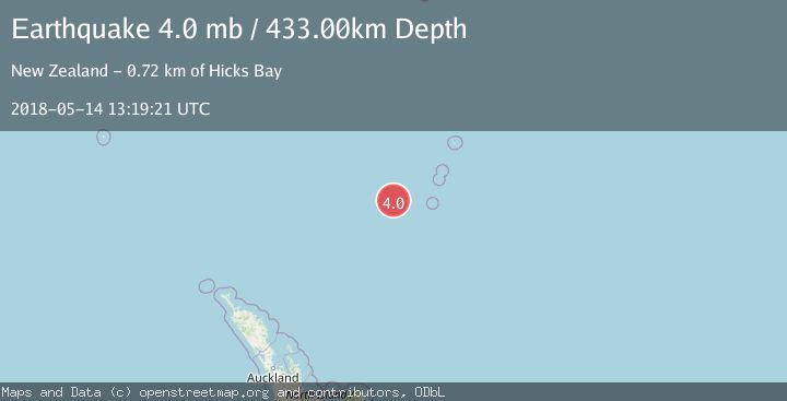
A 4.0 magnitude earthquake struck on KERMADEC ISLANDS REGION, at Mon, 14 May 2018 13:19:21 GMT. Depth: 433km. Reviewed by NEIC seismologists, this light quake occurred at a magnitude type of mb.
Magnitude
4.0
mb
Source
NEIC
Intensity
-
Agency Reports
1 Sources| Source | Magnitude | Depth | Time |
|---|---|---|---|
| NEICPrimary | 4.0 | 433 km | 7 years ago |
Earthquake Details
AutomaticEvent IDemsc_NEIC_20180514_0000178
Tsunami PotentialNo
Magnitude Typemb
Nearest Places
- Havre Trough87.2 km
- Havre Seamount126.6 km
- Havre Rock130.6 km
- L'Esperance Rock141.1 km
- Oliver Knoll143.3 km
Comments
Join the discussion about this event.
Latest Earthquakes
2.6Mag
near the coast of Tarapaca, Chile
Time33 seconds ago
Depth71.53 km
SourceVYT (Automatic)
3.8Mag
Molucca Sea
Time1 minute ago
Depth47.00 km
SourceVYT (Automatic)
1.9Mag
6 km NW of Pinnacles, CA
Time5 minutes ago
Depth4.82 km
SourceUSGS (Automatic)
1.2Mag
Southern Yukon Territory, Canada
Time17 minutes ago
Depth0.00 km
SourceVYT (Automatic)
3.6Mag
Jujuy, Argentina
Time18 minutes ago
Depth228.27 km
SourceVYT (Automatic)
Nearby Earthquakes
3.0Mag
KERMADEC ISLANDS REGION
Time1 year ago
Depth425.40 km
SourceGNS (Automatic)
4.0Mag
KERMADEC ISLANDS REGION
Time3 years ago
Depth395.00 km
SourceNEIC (Automatic)
5.6Mag
KERMADEC ISLANDS REGION
Time2 years ago
Depth446.00 km
SourceEMSC (Automatic)
3.4Mag
KERMADEC ISLANDS REGION
Time5 hours ago
Depth407.90 km
SourceGNS (Automatic)
4.0Mag
KERMADEC ISLANDS REGION
Time1 year ago
Depth544.80 km
SourceNEIC (Automatic)