Earthquake NORTH ISLAND OF NEW ZEALAND
Sat, 27 Feb 2021 23:59:01 GMT
Time4 years ago
Location
-40.3400, 176.6400
Depth
16.0 KM
Event Summary
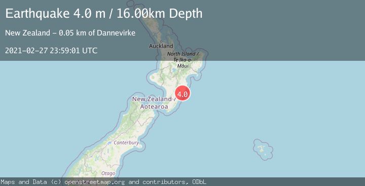
A 4.0 magnitude earthquake struck on NORTH ISLAND OF NEW ZEALAND, at Sat, 27 Feb 2021 23:59:01 GMT. Depth: 16km. Reviewed by GNS seismologists, this light quake occurred at a magnitude type of m.
Magnitude
4.0
m
Source
GNS
Intensity
-
Agency Reports
1 Sources| Source | Magnitude | Depth | Time |
|---|---|---|---|
| GNSPrimary | 4.0 | 16 km | 4 years ago |
Earthquake Details
AutomaticEvent IDemsc_GNS_20210227_0000199
Tsunami PotentialNo
Magnitude Typem
Nearest Places
- Mangareia Stream2.5 km
- Ngamahunga2.5 km
- Mangareia2.7 km
- Kaitoke2.8 km
- Mount Pleasant3.2 km
Comments
Join the discussion about this event.
Latest Earthquakes
2.9Mag
Central Alaska
Time4 minutes ago
Depth0.00 km
SourceVYT (Automatic)
1.9Mag
Kenai Peninsula, Alaska
Time5 minutes ago
Depth67.87 km
SourceVYT (Automatic)
1.2Mag
Southeastern Alaska
Time10 minutes ago
Depth35.28 km
SourceVYT (Automatic)
3.3Mag
off the coast of Libertador O'Higgins, Chile
Time14 minutes ago
Depth10.00 km
SourceVYT (Automatic)
1.0Mag
6 km SSW of Redlands, CA
Time16 minutes ago
Depth10.39 km
SourceUSGS (Automatic)
Nearby Earthquakes
5.4Mag
NORTH ISLAND OF NEW ZEALAND
Time2 years ago
Depth25.00 km
SourceEMSC (Automatic)
3.0Mag
NORTH ISLAND OF NEW ZEALAND
Time3 years ago
Depth12.00 km
SourceGNS (Automatic)
3.0Mag
NORTH ISLAND OF NEW ZEALAND
Time2 years ago
Depth16.00 km
SourceGNS (Automatic)
4.0Mag
NORTH ISLAND OF NEW ZEALAND
Time2 years ago
Depth10.00 km
SourceGNS (Automatic)
3.0Mag
NORTH ISLAND OF NEW ZEALAND
Time3 years ago
Depth14.00 km
SourceGNS (Automatic)