Earthquake NORTH ISLAND OF NEW ZEALAND
Wed, 07 Jan 2026 18:34:22 GMT
Time1 month ago
Location
-38.2622, 175.9235
Depth
171.0 KM
Event Summary
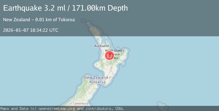
A 3.2 magnitude earthquake struck on NORTH ISLAND OF NEW ZEALAND, at Wed, 07 Jan 2026 18:34:22 GMT. Depth: 171km. Reviewed by GNS seismologists, this minor quake occurred at a magnitude type of ml.
Magnitude
3.2
ml
Source
GNS
Intensity
-
Agency Reports
1 Sources| Source | Magnitude | Depth | Time |
|---|---|---|---|
| GNSPrimary | 3.2 | 171 km | 1 month ago |
Earthquake Details
AutomaticEvent IDemsc_GNS_20260107_0000321
Tsunami PotentialNo
Magnitude Typeml
Nearest Places
- Kinleith3.1 km
- Kinleith3.4 km
- Tokoroa Airfield4.0 km
- Uraura4.3 km
- Mangawhara Stream4.4 km
Comments
Join the discussion about this event.
Latest Earthquakes
2.0Mag
Kenai Peninsula, Alaska
Time1 minute ago
Depth72.27 km
SourceVYT (Automatic)
2.0Mag
Central Alaska
Time5 minutes ago
Depth216.92 km
SourceVYT (Automatic)
1.8Mag
Region Metropolitana, Chile
Time9 minutes ago
Depth14.89 km
SourceVYT (Automatic)
4.9Mag
Kepulauan Aru region, Indonesia
Time9 minutes ago
Depth0.00 km
SourceVYT (Automatic)
2.5Mag
Poland
Time9 minutes ago
Depth0.24 km
SourceVYT (Automatic)
Nearby Earthquakes
3.0Mag
NORTH ISLAND OF NEW ZEALAND
Time1 year ago
Depth150.80 km
SourceGNS (Automatic)
3.0Mag
NORTH ISLAND OF NEW ZEALAND
Time3 years ago
Depth140.00 km
SourceGNS (Automatic)
5.0Mag
NORTH ISLAND OF NEW ZEALAND
Time4 years ago
Depth174.00 km
SourceEMSC (Automatic)
3.1Mag
NORTH ISLAND OF NEW ZEALAND
Time1 month ago
Depth181.50 km
SourceGNS (Automatic)
3.0Mag
NORTH ISLAND OF NEW ZEALAND
Time1 year ago
Depth164.00 km
SourceGNS (Automatic)