Earthquake NEAR EAST COAST OF KAMCHATKA
Fri, 20 Feb 2026 12:34:16 GMT
Time19 hours ago
Location
51.6700, 158.4700
Depth
50.0 KM
Event Summary
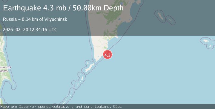
A 4.3 magnitude earthquake struck on NEAR EAST COAST OF KAMCHATKA, at Fri, 20 Feb 2026 12:34:16 GMT. Depth: 50km. Reviewed by GSRAS seismologists, this light quake occurred at a magnitude type of mb.
Magnitude
4.3
mb
Source
GSRAS
Intensity
-
Agency Reports
1 Sources| Source | Magnitude | Depth | Time |
|---|---|---|---|
| GSRASPrimary | 4.3 | 50 km | 19 hours ago |
Earthquake Details
AutomaticEvent IDemsc_GSRAS_20260220_0000194
Tsunami PotentialNo
Magnitude Typemb
Nearest Places
- 30.2 km
- 30.6 km
- 30.6 km
- 31.5 km
- 32.1 km
Comments
Join the discussion about this event.
Latest Earthquakes
3.7Mag
Kepulauan Tanimbar, Indonesia
Time18 hours ago
Depth10.00 km
SourceVYT (Automatic)
4.6Mag
West Papua Region, Indonesia
Time18 hours ago
Depth24.86 km
SourceBMKG
1.5Mag
35 km SE of Minto, Alaska
Time18 hours ago
Depth0.10 km
SourceUSGS (Automatic)
3.7Mag
Banda Sea
Time18 hours ago
Depth237.55 km
SourceVYT (Automatic)
2.2Mag
AEGEAN SEA
Time18 hours ago
Depth12.80 km
SourceKOERI (Automatic)
Nearby Earthquakes
3.6Mag
NEAR EAST COAST OF KAMCHATKA
Time1 month ago
Depth50.00 km
SourceGSRAS (Automatic)
5.3Mag
NEAR EAST COAST OF KAMCHATKA
Time2 years ago
Depth56.00 km
SourceEMSC (Automatic)
5.1Mag
NEAR EAST COAST OF KAMCHATKA
Time1 month ago
Depth47.00 km
SourceEMSC (Automatic)
6.2Mag
NEAR EAST COAST OF KAMCHATKA
Time0 months ago
Depth10.00 km
SourceGFZ (Automatic)
6.1Mag
NEAR EAST COAST OF KAMCHATKA
Time4 months ago
Depth48.90 km
SourceEMSC (Automatic)