Earthquake STRAIT OF GIBRALTAR
Sat, 17 Jan 2026 19:31:55 GMT
Time1 month ago
Location
36.3659, -7.7243
Depth
14.0 KM
Event Summary
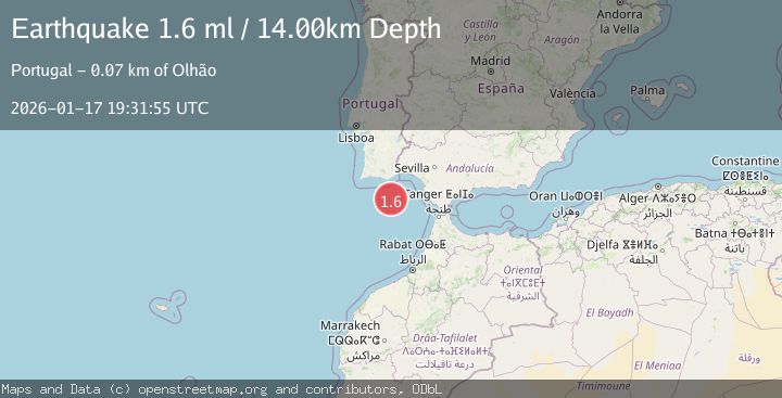
A 1.6 magnitude earthquake struck on STRAIT OF GIBRALTAR, at Sat, 17 Jan 2026 19:31:55 GMT. Depth: 14km. Reviewed by IGN seismologists, this minor quake occurred at a magnitude type of ml.
Magnitude
1.6
ml
Source
IGN
Intensity
-
Agency Reports
1 Sources| Source | Magnitude | Depth | Time |
|---|---|---|---|
| IGNPrimary | 1.6 | 14 km | 1 month ago |
Earthquake Details
AutomaticEvent IDemsc_IGN_20260117_0000228
Tsunami PotentialNo
Magnitude Typeml
Nearest Places
- Ribeira da Pardiela13.2 km
- Faro Canyon25.0 km
- Barra Nova67.7 km
- Cabo de Santa Maria67.7 km
- Praia Da Ilha Deserta67.8 km
Comments
Join the discussion about this event.
Latest Earthquakes
4.5Mag
Central Alaska
Time2 minutes ago
Depth7.81 km
SourceVYT (Automatic)
1.9Mag
1 km SSW of Pāhala, Hawaii
Time6 minutes ago
Depth28.47 km
SourceUSGS (Automatic)
1.5Mag
5 km NW of The Geysers, CA
Time7 minutes ago
Depth2.47 km
SourceUSGS (Automatic)
0.3Mag
10 km WNW of The Geysers, CA
Time9 minutes ago
Depth2.50 km
SourceUSGS (Automatic)
2.5Mag
Central Alaska
Time11 minutes ago
Depth112.55 km
SourceVYT (Automatic)
Nearby Earthquakes
3.0Mag
STRAIT OF GIBRALTAR
Time19 years ago
Depth40.00 km
SourceEMSC (Automatic)
2.6Mag
STRAIT OF GIBRALTAR
Time1 week ago
Depth14.50 km
SourceIGN (Automatic)
2.2Mag
STRAIT OF GIBRALTAR
Time2 weeks ago
Depth19.90 km
SourceIGN (Automatic)
3.0Mag
STRAIT OF GIBRALTAR
Time2 years ago
Depth15.00 km
SourceEMSC (Automatic)
3.0Mag
STRAIT OF GIBRALTAR
Time23 years ago
Depth60.00 km
SourceEMSC (Automatic)