Earthquake STRAIT OF GIBRALTAR
Thu, 29 Jan 2026 08:18:33 GMT
Time4 hours ago
Location
36.4703, -7.7150
Depth
19.9 KM
Event Summary
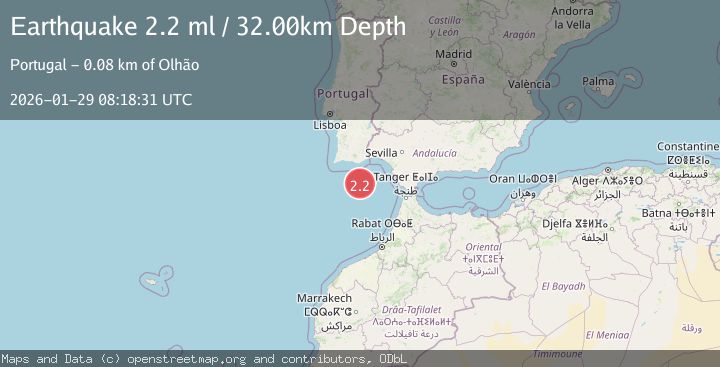
A 2.2 magnitude earthquake struck on STRAIT OF GIBRALTAR, at Thu, 29 Jan 2026 08:18:33 GMT. Depth: 19.9km. Reviewed by IGN seismologists, this minor quake occurred at a magnitude type of ml.
Magnitude
2.2
ml
Source
IGN
Intensity
-
Agency Reports
1 Sources| Source | Magnitude | Depth | Time |
|---|---|---|---|
| IGNPrimary | 2.2 | 20 km | 4 hours ago |
Earthquake Details
AutomaticEvent IDemsc_IGN_20260129_0000115
Tsunami PotentialNo
Magnitude Typeml
Nearest Places
- Ribeira da Pardiela2.0 km
- Faro Canyon29.7 km
- Barra Nova56.6 km
- Cabo de Santa Maria56.7 km
- Praia Da Ilha Deserta56.7 km
Comments
Join the discussion about this event.
Latest Earthquakes
0.8Mag
4 km NW of The Geysers, CA
Time3 hours ago
Depth2.91 km
SourceUSGS (Automatic)
2.0Mag
WESTERN TURKEY
Time4 hours ago
Depth9.50 km
SourceKOERI (Automatic)
3.4Mag
South of Java, Indonesia
Time4 hours ago
Depth102.09 km
SourceBMKG (Automatic)
1.9Mag
9 km E of Alum Rock, CA
Time4 hours ago
Depth6.05 km
SourceUSGS (Automatic)
1.5Mag
GERMANY
Time4 hours ago
Depth11.70 km
SourceETHZ (Automatic)
Nearby Earthquakes
3.7Mag
STRAIT OF GIBRALTAR
Time1 day ago
Depth25.10 km
SourceIGN (Automatic)
2.0Mag
STRAIT OF GIBRALTAR
Time5 days ago
Depth30.00 km
SourceIGN (Automatic)
2.8Mag
STRAIT OF GIBRALTAR
Time3 days ago
Depth29.80 km
SourceIGN (Automatic)
2.5Mag
WEST OF GIBRALTAR
Time2 days ago
Depth46.30 km
SourceEMSC (Automatic)
1.6Mag
PORTUGAL
Time13 hours ago
Depth23.10 km
SourceIGN (Automatic)