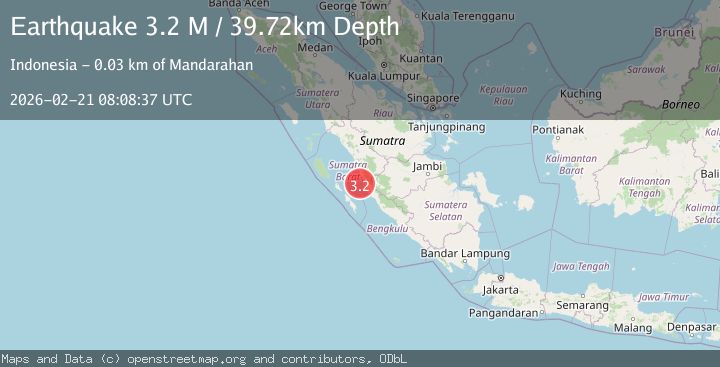
Earthquake southern Sumatra, Indonesia
Sat, 21 Feb 2026 08:08:37 GMT
Time1 hour ago
Location
-1.9858, 100.2489
Depth
28.7 KM
Event Summary
A 3.3 magnitude earthquake struck on southern Sumatra, Indonesia, at Sat, 21 Feb 2026 08:08:37 GMT. Depth: 28.6865234375km. Reviewed by VYT seismologists, this minor quake occurred at a magnitude type of earthquake.
Magnitude
3.3
earthquake
Source
VYT
Intensity
-
Agency Reports
1 Sources| Source | Magnitude | Depth | Time |
|---|---|---|---|
| VYTPrimary | 3.3 | 29 km | 1 hour ago |
Earthquake Details
AutomaticEvent IDvyt_2iur2m2ka4moe
Tsunami PotentialNo
Magnitude Typeearthquake
Nearest Places
- 37.0 km
- 38.1 km
- 44.4 km
- 45.7 km
- 48.6 km
Comments
Join the discussion about this event.
Latest Earthquakes
3.0Mag
South of Sumbawa, Indonesia
Time1 hour ago
Depth10.00 km
SourceBMKG
1.9Mag
14 km S of Volcano, Hawaii
Time1 hour ago
Depth4.23 km
SourceUSGS (Automatic)
1.9Mag
Central Alaska
Time1 hour ago
Depth27.34 km
SourceVYT (Automatic)
1.1Mag
Fox Islands, Aleutian Islands, Alaska
Time1 hour ago
Depth0.00 km
SourceVYT (Automatic)
0.3Mag
9 km NW of The Geysers, CA
Time1 hour ago
Depth1.82 km
SourceUSGS (Automatic)
Nearby Earthquakes
5.0Mag
SOUTHERN SUMATRA, INDONESIA
Time6 years ago
Depth60.00 km
SourceEMSC (Automatic)
5.1Mag
KEP. MENTAWAI REGION, INDONESIA
Time19 years ago
Depth60.00 km
SourceEMSC (Automatic)
6.6Mag
SOUTHERN SUMATRA, INDONESIA
Time18 years ago
Depth40.00 km
SourceEMSC (Automatic)
5.1Mag
SOUTHERN SUMATRA, INDONESIA
Time5 years ago
Depth33.00 km
SourceEMSC (Automatic)
5.0Mag
SOUTHERN SUMATRA, INDONESIA
Time18 years ago
Depth77.00 km
SourceEMSC (Automatic)