Earthquake PYRENEES
Fri, 13 Feb 2026 01:37:05 GMT
Time6 days ago
Location
42.9588, -0.7605
Depth
4.2 KM
Event Summary
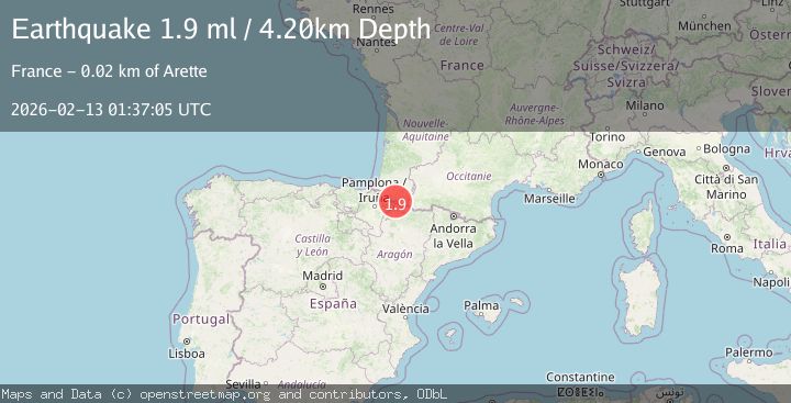
A 1.9 magnitude earthquake struck on PYRENEES, at Fri, 13 Feb 2026 01:37:05 GMT. Depth: 4.2km. Reviewed by IGN seismologists, this minor quake occurred at a magnitude type of ml.
Magnitude
1.9
ml
Source
IGN
Intensity
-
Agency Reports
1 Sources| Source | Magnitude | Depth | Time |
|---|---|---|---|
| IGNPrimary | 1.9 | 4 km | 6 days ago |
Earthquake Details
AutomaticEvent IDemsc_IGN_20260213_0000029
Tsunami PotentialNo
Magnitude Typeml
Nearest Places
- Col de Pescamou1.0 km
- Pic d'Arlas1.2 km
- Soum de Lèche1.7 km
- Arette-Pierre-Saint-Martin2.6 km
- Añelarra3.3 km
Comments
Join the discussion about this event.
Latest Earthquakes
1.3Mag
Southeastern Alaska
Time4 minutes ago
Depth1.71 km
SourceVYT (Automatic)
2.9Mag
Central Alaska
Time9 minutes ago
Depth0.00 km
SourceVYT (Automatic)
1.9Mag
Kenai Peninsula, Alaska
Time10 minutes ago
Depth67.87 km
SourceVYT (Automatic)
1.2Mag
Southeastern Alaska
Time15 minutes ago
Depth35.28 km
SourceVYT (Automatic)
3.3Mag
off the coast of Libertador O'Higgins, Chile
Time19 minutes ago
Depth10.00 km
SourceVYT (Automatic)
Nearby Earthquakes
1.6Mag
PYRENEES
Time3 days ago
Depth7.20 km
SourceIGN (Automatic)
1.8Mag
PYRENEES
Time1 month ago
Depth10.10 km
SourceIGN (Automatic)
2.5Mag
PYRENEES
Time3 weeks ago
Depth5.00 km
SourceReNaSS (Automatic)
2.3Mag
PYRENEES
Time3 weeks ago
Depth5.00 km
SourceReNaSS (Automatic)
3.0Mag
PYRENEES
Time4 years ago
Depth5.00 km
SourceEMSC (Automatic)