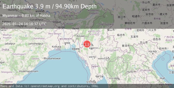
Earthquake MYANMAR-INDIA BORDER REGION
Sat, 24 Jan 2026 14:18:37 GMT
Time2 days ago
Location
22.6859, 93.9265
Depth
94.9 KM
Event Summary
A 3.9 magnitude earthquake struck on MYANMAR-INDIA BORDER REGION, at Sat, 24 Jan 2026 14:18:37 GMT. Depth: 94.9km. Reviewed by NDI seismologists, this minor quake occurred at a magnitude type of m.
Magnitude
3.9
m
Source
NDI
Intensity
-
Agency Reports
1 Sources| Source | Magnitude | Depth | Time |
|---|---|---|---|
| NDIPrimary | 3.9 | 95 km | 2 days ago |
Earthquake Details
AutomaticEvent IDemsc_NDI_20260124_0000268
Tsunami PotentialNo
Magnitude Typem
Nearest Places
- Ruanlung Klang2.4 km
- Ruan9.3 km
- Sih-hai9.6 km
- Hata10.7 km
- Vanha11.1 km
Comments
Join the discussion about this event.
Latest Earthquakes
1.4Mag
41 km NW of Toyah, Texas
Time6 minutes ago
Depth2.74 km
SourceUSGS (Automatic)
2.0Mag
Sumbawa Region, Indonesia
Time10 minutes ago
Depth107.77 km
SourceBMKG (Automatic)
1.7Mag
26 km WNW of Ludlow, CA
Time14 minutes ago
Depth1.36 km
SourceUSGS (Automatic)
3.1Mag
HAITI REGION
Time17 minutes ago
Depth7.00 km
SourceAYIT (Automatic)
2.6Mag
PUERTO RICO
Time23 minutes ago
Depth16.10 km
SourcePR (Automatic)
Nearby Earthquakes
4.1Mag
MYANMAR-INDIA BORDER REGION
Time2 days ago
Depth55.50 km
SourceNDI (Automatic)
4.4Mag
MANIPUR, INDIA REGION
Time5 days ago
Depth10.00 km
SourceNDI (Automatic)
3.1Mag
MYANMAR
Time1 day ago
Depth10.00 km
SourceTSB (Automatic)
3.4Mag
MYANMAR
Time6 days ago
Depth10.00 km
SourceTSB (Automatic)
3.0Mag
MYANMAR
Time4 days ago
Depth10.00 km
SourceTSB (Automatic)