Earthquake 41 km NW of Toyah, Texas
Tue, 27 Jan 2026 14:06:52 GMT
Time1 hour ago
Location
31.5250, -104.1510
Depth
2.7 KM
Event Summary
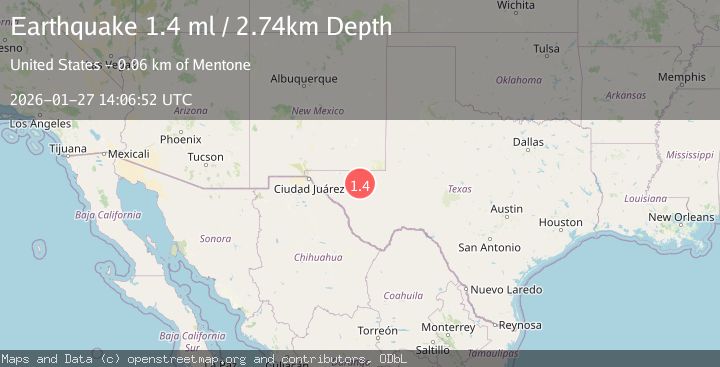
A 1.4 magnitude earthquake struck on 41 km NW of Toyah, Texas, at Tue, 27 Jan 2026 14:06:52 GMT. Depth: 2.7364km. Reviewed by USGS seismologists, this minor quake occurred at a magnitude type of ml.
Magnitude
1.4
ml
Source
USGS
Intensity
-
Agency Reports
1 Sources| Source | Magnitude | Depth | Time |
|---|---|---|---|
| USGSPrimary | 1.4 | 3 km | 1 hour ago |
Earthquake Details
AutomaticEvent IDusgs_tx2026bwuynh
Tsunami PotentialNo
Magnitude Typeml
Nearest Places
- Brooks Ranch0.8 km
- Two Mill Draw1.0 km
- Big Canyon Draw1.7 km
- Gulf Windmill3.7 km
- Little Sulphur Windmill6.7 km
Comments
Join the discussion about this event.
Latest Earthquakes
3.7Mag
Java, Indonesia
Time9 minutes ago
Depth26.88 km
SourceBMKG (Automatic)
1.7Mag
20 km ENE of Arvin, CA
Time10 minutes ago
Depth5.64 km
SourceUSGS (Automatic)
2.3Mag
57 km E of Pedro Bay, Alaska
Time16 minutes ago
Depth120.40 km
SourceUSGS (Automatic)
2.3Mag
Bali Sea
Time17 minutes ago
Depth13.31 km
SourceBMKG (Automatic)
1.9Mag
97 km S of Kokhanok, Alaska
Time22 minutes ago
Depth5.00 km
SourceUSGS (Automatic)
Nearby Earthquakes
1.5Mag
40 km WNW of Toyah, Texas
Time3 days ago
Depth4.04 km
SourceUSGS (Automatic)
1.7Mag
44 km NW of Toyah, Texas
Time3 days ago
Depth4.27 km
SourceUSGS (Automatic)
1.5Mag
36 km NW of Toyah, Texas
Time2 days ago
Depth5.77 km
SourceUSGS (Automatic)
1.5Mag
31 km NW of Toyah, Texas
Time4 days ago
Depth4.49 km
SourceUSGS (Automatic)
1.5Mag
37 km NW of Toyah, Texas
Time5 days ago
Depth6.63 km
SourceUSGS (Automatic)