Earthquake MANIPUR, INDIA REGION
Wed, 21 Jan 2026 16:47:59 GMT
Time6 days ago
Location
24.2461, 93.7489
Depth
10.0 KM
Event Summary
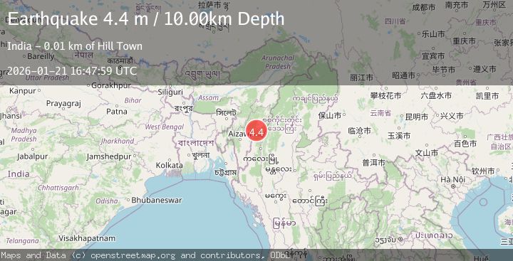
A 4.4 magnitude earthquake struck on MANIPUR, INDIA REGION, at Wed, 21 Jan 2026 16:47:59 GMT. Depth: 10km. Reviewed by NDI seismologists, this light quake occurred at a magnitude type of m.
Magnitude
4.4
m
Source
NDI
Intensity
-
Agency Reports
1 Sources| Source | Magnitude | Depth | Time |
|---|---|---|---|
| NDIPrimary | 4.4 | 10 km | 6 days ago |
Earthquake Details
AutomaticEvent IDemsc_NDI_20260121_0000328
Tsunami PotentialNo
Magnitude Typem
Nearest Places
- Khoinoi4.1 km
- Saikot4.2 km
- Sangaikot5.8 km
- Churachandpur8.2 km
- Mulam8.8 km
Comments
Join the discussion about this event.
Latest Earthquakes
3.7Mag
Java, Indonesia
Time1 hour ago
Depth26.88 km
SourceBMKG (Automatic)
1.7Mag
20 km ENE of Arvin, CA
Time1 hour ago
Depth5.64 km
SourceUSGS (Automatic)
2.3Mag
57 km E of Pedro Bay, Alaska
Time1 hour ago
Depth120.40 km
SourceUSGS (Automatic)
2.3Mag
Bali Sea
Time1 hour ago
Depth13.31 km
SourceBMKG (Automatic)
1.9Mag
97 km S of Kokhanok, Alaska
Time1 hour ago
Depth5.00 km
SourceUSGS (Automatic)
Nearby Earthquakes
4.2Mag
MYANMAR-INDIA BORDER REGION
Time3 days ago
Depth105.50 km
SourceNDI (Automatic)
3.9Mag
MYANMAR-INDIA BORDER REGION
Time3 days ago
Depth94.90 km
SourceNDI (Automatic)
4.1Mag
MYANMAR-INDIA BORDER REGION
Time2 days ago
Depth55.50 km
SourceNDI (Automatic)
4.0Mag
MYANMAR-INDIA BORDER REGION
Time4 days ago
Depth90.00 km
SourceNDI (Automatic)
3.0Mag
MEGHALAYA - ASSAM REGION, INDIA
Time5 days ago
Depth10.00 km
SourceNDI (Automatic)