Earthquake MYANMAR-INDIA BORDER REGION
Sat, 21 Feb 2026 19:51:48 GMT
Time1 hour ago
Location
24.2600, 94.3000
Depth
10.0 KM
Event Summary
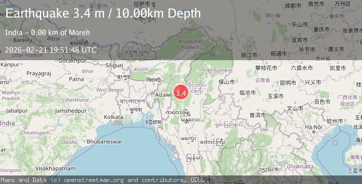
A 3.4 magnitude earthquake struck on MYANMAR-INDIA BORDER REGION, at Sat, 21 Feb 2026 19:51:48 GMT. Depth: 10km. Reviewed by NDI seismologists, this minor quake occurred at a magnitude type of m.
Magnitude
3.4
m
Source
NDI
Intensity
-
Agency Reports
1 Sources| Source | Magnitude | Depth | Time |
|---|---|---|---|
| NDIPrimary | 3.4 | 10 km | 1 hour ago |
Earthquake Details
AutomaticEvent IDemsc_NDI_20260221_0000288
Tsunami PotentialNo
Magnitude Typem
Nearest Places
- 1.0 km
- 2.0 km
- 4.5 km
- 4.7 km
- 2Tamu5.0 km
Comments
Join the discussion about this event.
Latest Earthquakes
1.7Mag
32 km SE of Naalehu, Hawaii
Time1 hour ago
Depth15.81 km
SourceUSGS (Automatic)
1.3Mag
6 km NW of The Geysers, CA
Time1 hour ago
Depth2.94 km
SourceUSGS (Automatic)
2.2Mag
Fox Islands, Aleutian Islands, Alaska
Time1 hour ago
Depth46.75 km
SourceVYT (Automatic)
3.0Mag
Sumbawa region, Indonesia
Time1 hour ago
Depth122.80 km
SourceVYT (Automatic)
2.8Mag
Antofagasta, Chile
Time1 hour ago
Depth138.92 km
SourceVYT (Automatic)
Nearby Earthquakes
4.0Mag
MYANMAR-INDIA BORDER REGION
Time3 months ago
Depth90.00 km
SourceNDI (Automatic)
3.0Mag
MYANMAR-INDIA BORDER REGION
Time4 years ago
Depth10.00 km
SourceNDI (Automatic)
3.5Mag
MYANMAR-INDIA BORDER REGION
Time1 month ago
Depth108.00 km
SourceNDI (Automatic)
3.0Mag
MYANMAR-INDIA BORDER REGION
Time3 years ago
Depth50.00 km
SourceNDI (Automatic)
5.0Mag
MYANMAR-INDIA BORDER REGION
Time9 years ago
Depth10.00 km
SourceEMSC (Automatic)