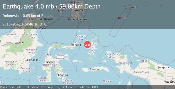
Earthquake HALMAHERA, INDONESIA
Sun, 13 May 2018 14:48:16 GMT
Time7 years ago
Location
1.1800, 127.0000
Depth
59.0 KM
Event Summary
A 4.0 magnitude earthquake struck on HALMAHERA, INDONESIA, at Sun, 13 May 2018 14:48:16 GMT. Depth: 59km. Reviewed by NEIC seismologists, this light quake occurred at a magnitude type of mb.
Magnitude
4.0
mb
Source
NEIC
Intensity
-
Agency Reports
1 Sources| Source | Magnitude | Depth | Time |
|---|---|---|---|
| NEICPrimary | 4.0 | 59 km | 7 years ago |
Earthquake Details
AutomaticEvent IDemsc_NEIC_20180513_0000207
Tsunami PotentialNo
Magnitude Typemb
Nearest Places
- Nyi38.6 km
- Tanjung Roromadehe44.6 km
- Desa Todahe45.3 km
- Todahe45.5 km
- Pulau Maka45.5 km
Comments
Join the discussion about this event.
Latest Earthquakes
3.6Mag
Fox Islands, Aleutian Islands, Alaska
Time2 minutes ago
Depth28.81 km
SourceVYT (Automatic)
1.3Mag
Washington
Time3 minutes ago
Depth0.00 km
SourceVYT (Automatic)
2.0Mag
Antofagasta, Chile
Time4 minutes ago
Depth28.32 km
SourceVYT (Automatic)
1.2Mag
Central Alaska
Time5 minutes ago
Depth0.00 km
SourceVYT (Automatic)
2.1Mag
Sulawesi, Indonesia
Time6 minutes ago
Depth7.10 km
SourceBMKG
Nearby Earthquakes
3.1Mag
HALMAHERA, INDONESIA
Time1 month ago
Depth16.00 km
SourceBMKG (Automatic)
2.9Mag
Northern Molucca Sea
Time2 weeks ago
Depth16.88 km
SourceBMKG (Automatic)
3.6Mag
Halmahera, Indonesia
Time5 days ago
Depth125.73 km
SourceVYT (Automatic)
2.7Mag
HALMAHERA, INDONESIA
Time1 month ago
Depth29.00 km
SourceBMKG (Automatic)
3.0Mag
MOLUCCA SEA
Time1 month ago
Depth13.00 km
SourceBMKG (Automatic)