Earthquake HALMAHERA, INDONESIA
Fri, 02 Jan 2026 09:45:37 GMT
Time1 month ago
Location
1.2300, 127.0100
Depth
29.0 KM
Event Summary
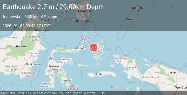
A 2.7 magnitude earthquake struck on HALMAHERA, INDONESIA, at Fri, 02 Jan 2026 09:45:37 GMT. Depth: 29km. Reviewed by BMKG seismologists, this minor quake occurred at a magnitude type of m.
Magnitude
2.7
m
Source
BMKG
Intensity
-
Agency Reports
1 Sources| Source | Magnitude | Depth | Time |
|---|---|---|---|
| BMKGPrimary | 2.7 | 29 km | 1 month ago |
Earthquake Details
AutomaticEvent IDemsc_BMKG_20260102_0000119
Tsunami PotentialNo
Magnitude Typem
Nearest Places
- Nyi32.9 km
- Tanjung Roromadehe43.6 km
- Tanjung Gammadehe44.2 km
- Desa Todahe44.4 km
- Peot44.4 km
Comments
Join the discussion about this event.
Latest Earthquakes
2.7Mag
Near North Coast of West Papua
Time10 minutes ago
Depth45.06 km
SourceBMKG
1.2Mag
Central Alaska
Time11 minutes ago
Depth0.85 km
SourceVYT (Automatic)
2.6Mag
West Papua Region, Indonesia
Time14 minutes ago
Depth10.00 km
SourceBMKG
2.3Mag
WESTERN TURKEY
Time17 minutes ago
Depth10.10 km
SourceKOERI (Automatic)
2.6Mag
Antofagasta, Chile
Time18 minutes ago
Depth0.00 km
SourceVYT (Automatic)
Nearby Earthquakes
4.0Mag
HALMAHERA, INDONESIA
Time7 years ago
Depth59.00 km
SourceNEIC (Automatic)
2.9Mag
Northern Molucca Sea
Time2 weeks ago
Depth16.88 km
SourceBMKG (Automatic)
3.6Mag
Halmahera, Indonesia
Time5 days ago
Depth125.73 km
SourceVYT (Automatic)
3.1Mag
HALMAHERA, INDONESIA
Time1 month ago
Depth16.00 km
SourceBMKG (Automatic)
5.1Mag
HALMAHERA, INDONESIA
Time6 years ago
Depth132.00 km
SourceEMSC (Automatic)