Earthquake SOUTHERN ALASKA
Wed, 16 Sep 2020 23:20:19 GMT
Time5 years ago
Location
59.8900, -153.3600
Depth
137.0 KM
Event Summary
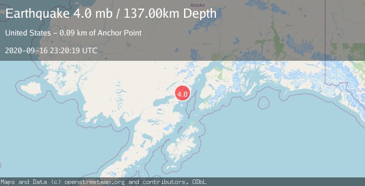
A 4.0 magnitude earthquake struck on SOUTHERN ALASKA, at Wed, 16 Sep 2020 23:20:19 GMT. Depth: 137km. Reviewed by NEIC seismologists, this light quake occurred at a magnitude type of mb.
Magnitude
4.0
mb
Source
NEIC
Intensity
-
Agency Reports
1 Sources| Source | Magnitude | Depth | Time |
|---|---|---|---|
| NEICPrimary | 4.0 | 137 km | 5 years ago |
Earthquake Details
AutomaticEvent IDemsc_NEIC_20200916_0000168
Tsunami PotentialNo
Magnitude Typemb
Nearest Places
- Holland Creek5.8 km
- Left Fork West Glacier Creek5.8 km
- Right Fork West Glacier Creek5.8 km
- Tooie Creek7.6 km
- Brown Mountain7.8 km
Comments
Join the discussion about this event.
Latest Earthquakes
2.8Mag
Fox Islands, Aleutian Islands, Alaska
Time3 minutes ago
Depth80.44 km
SourceVYT (Automatic)
0.9Mag
110 km S of McCarthy, Alaska
Time6 minutes ago
Depth18.50 km
SourceUSGS (Automatic)
3.0Mag
Central Alaska
Time6 minutes ago
Depth0.12 km
SourceVYT (Automatic)
2.5Mag
Minahassa Peninsula, Sulawesi
Time8 minutes ago
Depth4.95 km
SourceBMKG
2.9Mag
Minahasa, Sulawesi, Indonesia
Time8 minutes ago
Depth10.86 km
SourceVYT (Automatic)
Nearby Earthquakes
3.0Mag
SOUTHERN ALASKA
Time3 years ago
Depth138.00 km
SourceNEIC (Automatic)
3.0Mag
SOUTHERN ALASKA
Time4 years ago
Depth136.00 km
SourceNEIC (Automatic)
3.0Mag
SOUTHERN ALASKA
Time8 years ago
Depth135.00 km
SourceNEIC (Automatic)
3.0Mag
SOUTHERN ALASKA
Time5 months ago
Depth118.20 km
SourceNEIC (Automatic)
3.0Mag
SOUTHERN ALASKA
Time3 years ago
Depth134.00 km
SourceNEIC (Automatic)