Earthquake SOUTHERN ALASKA
Thu, 16 Dec 2021 08:25:55 GMT
Time4 years ago
Location
59.8800, -153.3100
Depth
136.0 KM
Event Summary
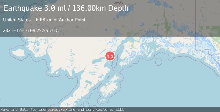
A 3.0 magnitude earthquake struck on SOUTHERN ALASKA, at Thu, 16 Dec 2021 08:25:55 GMT. Depth: 136km. Reviewed by NEIC seismologists, this minor quake occurred at a magnitude type of ml.
Magnitude
3.0
ml
Source
NEIC
Intensity
-
Agency Reports
1 Sources| Source | Magnitude | Depth | Time |
|---|---|---|---|
| NEICPrimary | 3.0 | 136 km | 4 years ago |
Earthquake Details
AutomaticEvent IDemsc_NEIC_20211216_0000119
Tsunami PotentialNo
Magnitude Typeml
Nearest Places
- Tooie Creek4.7 km
- Left Fork West Glacier Creek5.5 km
- Right Fork West Glacier Creek5.5 km
- Silver Salmon Creek5.6 km
- Marsh Creek5.8 km
Comments
Join the discussion about this event.
Latest Earthquakes
1.0Mag
Southeastern Alaska
Time3 minutes ago
Depth0.00 km
SourceVYT (Automatic)
3.5Mag
COOK STRAIT, NEW ZEALAND
Time4 minutes ago
Depth75.30 km
SourceGNS (Automatic)
2.4Mag
Seram, Indonesia
Time6 minutes ago
Depth18.42 km
SourceBMKG
2.6Mag
West Papua Region, Indonesia
Time8 minutes ago
Depth17.35 km
SourceBMKG
2.8Mag
Antofagasta, Chile
Time12 minutes ago
Depth0.00 km
SourceVYT (Automatic)
Nearby Earthquakes
3.0Mag
SOUTHERN ALASKA
Time8 years ago
Depth135.00 km
SourceNEIC (Automatic)
4.0Mag
SOUTHERN ALASKA
Time5 years ago
Depth137.00 km
SourceNEIC (Automatic)
3.0Mag
SOUTHERN ALASKA
Time3 years ago
Depth138.00 km
SourceNEIC (Automatic)
2.0Mag
48 km E of Pedro Bay, Alaska
Time1 week ago
Depth128.80 km
SourceUSGS (Automatic)
3.0Mag
SOUTHERN ALASKA
Time3 years ago
Depth134.00 km
SourceNEIC (Automatic)