Earthquake EASTERN MONTANA
Fri, 02 Jan 2026 20:22:55 GMT
Time1 month ago
Location
45.0730, -106.7917
Depth
0.0 KM
Event Summary
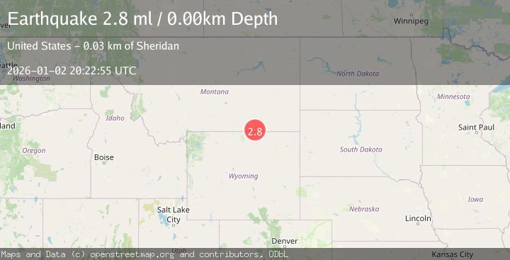
A 2.8 magnitude earthquake struck on EASTERN MONTANA, at Fri, 02 Jan 2026 20:22:55 GMT. Depth: 0km. Reviewed by NEIC seismologists, this minor quake occurred at a magnitude type of ml.
Magnitude
2.8
ml
Source
NEIC
Intensity
-
Agency Reports
1 Sources| Source | Magnitude | Depth | Time |
|---|---|---|---|
| NEICPrimary | 2.8 | 0 km | 1 month ago |
Earthquake Details
AutomaticEvent IDemsc_NEIC_20260102_0000349
Tsunami PotentialNo
Magnitude Typeml
Nearest Places
- 09S40E01CCAA01 Well0.8 km
- Deer Creek1.1 km
- 09S40E11ADAC01 Well1.2 km
- 09S40E11ADAC02 Well1.3 km
- 09S40E12BCAB01 Well1.3 km
Comments
Join the discussion about this event.
Latest Earthquakes
1.4Mag
4 km W of Lake Henshaw, CA
Time10 hours ago
Depth12.37 km
SourceUSGS (Automatic)
1.6Mag
41 km NW of Toyah, Texas
Time10 hours ago
Depth3.46 km
SourceUSGS (Automatic)
0.7Mag
6 km WNW of Cobb, CA
Time10 hours ago
Depth-0.59 km
SourceUSGS (Automatic)
1.0Mag
Southern Alaska
Time10 hours ago
Depth0.12 km
SourceVYT (Automatic)
2.1Mag
Sumbawa Region, Indonesia
Time10 hours ago
Depth21.86 km
SourceBMKG
Nearby Earthquakes
3.0Mag
EASTERN MONTANA
Time7 years ago
Depth6.00 km
SourceNEIR (Automatic)
3.0Mag
EASTERN MONTANA
Time1 year ago
Depth0.00 km
SourceNEIC (Automatic)
3.0Mag
WYOMING
Time9 years ago
Depth6.00 km
SourceNEIR (Automatic)
3.9Mag
Wyoming
Time5 days ago
Depth10.00 km
SourceVYT (Automatic)
3.0Mag
WYOMING
Time6 days ago
Depth10.20 km
SourceNEIC (Automatic)