Earthquake SOUTHERN CALIFORNIA
Sat, 10 Jan 2026 12:48:41 GMT
Time1 month ago
Location
33.7012, -116.8279
Depth
10.0 KM
Event Summary
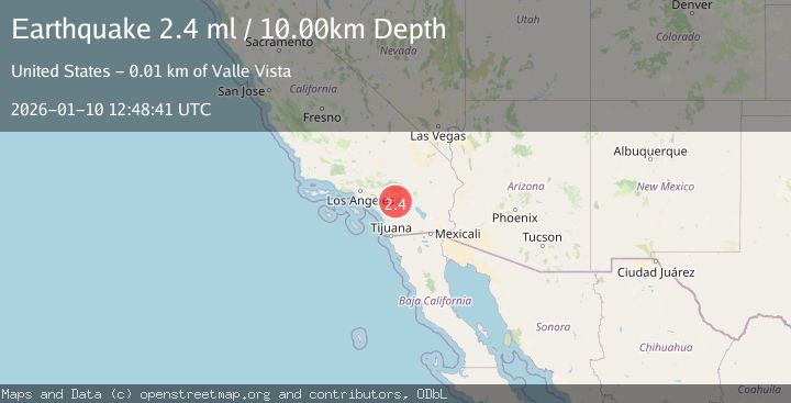
A 2.4 magnitude earthquake struck on SOUTHERN CALIFORNIA, at Sat, 10 Jan 2026 12:48:41 GMT. Depth: 10km. Reviewed by NEIC seismologists, this minor quake occurred at a magnitude type of ml.
Magnitude
2.4
ml
Source
NEIC
Intensity
-
Agency Reports
1 Sources| Source | Magnitude | Depth | Time |
|---|---|---|---|
| NEICPrimary | 2.4 | 10 km | 1 month ago |
Earthquake Details
AutomaticEvent IDemsc_NEIC_20260110_0000150
Tsunami PotentialNo
Magnitude Typeml
Nearest Places
- Blackburn Canyon2.0 km
- Bautista Canyon2.3 km
- Sand Canyon3.1 km
- Toll Road Canyon3.4 km
- Blackburn Ridge3.4 km
Comments
Join the discussion about this event.
Latest Earthquakes
3.5Mag
near the coast of Antofagasta, Chile
Time6 hours ago
Depth0.00 km
SourceVYT (Automatic)
1.7Mag
Southern California
Time6 hours ago
Depth0.00 km
SourceVYT (Automatic)
3.1Mag
northern Norway
Time6 hours ago
Depth707.40 km
SourceVYT (Automatic)
2.2Mag
DODECANESE IS.-TURKEY BORDER REG
Time6 hours ago
Depth46.60 km
SourceKOERI (Automatic)
2.4Mag
Albania
Time6 hours ago
Depth14.77 km
SourceVYT (Automatic)
Nearby Earthquakes
1.1Mag
7 km SE of Valle Vista, CA
Time3 weeks ago
Depth15.56 km
SourceUSGS (Automatic)
0.5Mag
9 km ESE of Valle Vista, CA
Time1 week ago
Depth16.04 km
SourceUSGS (Automatic)
1.0Mag
8 km WSW of Idyllwild, CA
Time2 weeks ago
Depth14.36 km
SourceUSGS (Automatic)
1.1Mag
9 km SW of Idyllwild, CA
Time1 week ago
Depth18.30 km
SourceUSGS (Automatic)
2.0Mag
SOUTHERN CALIFORNIA
Time1 month ago
Depth17.40 km
SourceSCSN (Automatic)