Earthquake SOUTHWEST OF SUMATRA, INDONESIA
Tue, 13 Jan 2026 09:53:40 GMT
Time1 month ago
Location
-5.1470, 101.8441
Depth
26.1 KM
Event Summary
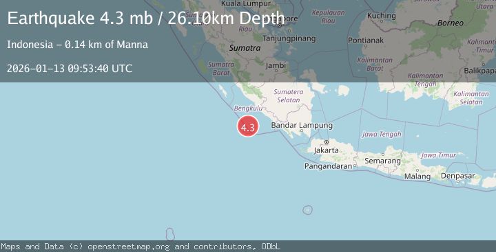
A 4.3 magnitude earthquake struck on SOUTHWEST OF SUMATRA, INDONESIA, at Tue, 13 Jan 2026 09:53:40 GMT. Depth: 26.1km. Reviewed by NEIC seismologists, this light quake occurred at a magnitude type of mb.
Magnitude
4.3
mb
Source
NEIC
Intensity
-
Agency Reports
1 Sources| Source | Magnitude | Depth | Time |
|---|---|---|---|
| NEICPrimary | 4.3 | 26 km | 1 month ago |
Earthquake Details
AutomaticEvent IDemsc_NEIC_20260113_0000391
Tsunami PotentialNo
Magnitude Typemb
Nearest Places
- Tanjung Kooma36.7 km
- Sungai Hubaje37.9 km
- Batang Mea38.2 km
- Desa Banjar Sari38.6 km
- Lakoaha38.7 km
Comments
Join the discussion about this event.
Latest Earthquakes
0.6Mag
12 km SE of Anza, CA
Time4 minutes ago
Depth6.49 km
SourceUSGS (Automatic)
2.6Mag
western Texas
Time6 minutes ago
Depth12.70 km
SourceVYT (Automatic)
2.0Mag
Sumbawa Region, Indonesia
Time7 minutes ago
Depth21.49 km
SourceBMKG
1.0Mag
Southern Alaska
Time8 minutes ago
Depth1.34 km
SourceVYT (Automatic)
1.7Mag
Dead Sea region
Time9 minutes ago
Depth0.00 km
SourceVYT (Automatic)
Nearby Earthquakes
4.1Mag
SOUTHWEST OF SUMATRA, INDONESIA
Time2 weeks ago
Depth30.00 km
SourceBMKG (Automatic)
5.4Mag
SOUTHWEST OF SUMATRA, INDONESIA
Time14 years ago
Depth20.00 km
SourceEMSC (Automatic)
5.3Mag
SOUTHERN SUMATRA, INDONESIA
Time9 years ago
Depth40.00 km
SourceEMSC (Automatic)
4.0Mag
SOUTHWEST OF SUMATRA, INDONESIA
Time3 years ago
Depth15.00 km
SourceDJA (Automatic)
4.0Mag
SOUTHERN SUMATRA, INDONESIA
Time6 years ago
Depth21.00 km
SourceDJA (Automatic)