Earthquake SOUTHWEST OF SUMATRA, INDONESIA
Sun, 01 Feb 2026 18:10:59 GMT
Time2 weeks ago
Location
-5.1600, 101.8500
Depth
30.0 KM
Event Summary
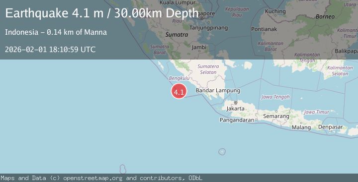
A 4.1 magnitude earthquake struck on SOUTHWEST OF SUMATRA, INDONESIA, at Sun, 01 Feb 2026 18:10:59 GMT. Depth: 30km. Reviewed by BMKG seismologists, this light quake occurred at a magnitude type of m.
Magnitude
4.1
m
Source
BMKG
Intensity
-
Agency Reports
1 Sources| Source | Magnitude | Depth | Time |
|---|---|---|---|
| BMKGPrimary | 4.1 | 30 km | 2 weeks ago |
Earthquake Details
AutomaticEvent IDemsc_BMKG_20260201_0000245
Tsunami PotentialNo
Magnitude Typem
Nearest Places
- Tanjung Kooma35.3 km
- Sungai Hubaje36.7 km
- Batang Mea37.0 km
- Desa Banjar Sari37.3 km
- Lakoaha37.6 km
Comments
Join the discussion about this event.
Latest Earthquakes
1.7Mag
Alaska Peninsula
Time2 minutes ago
Depth0.00 km
SourceVYT (Automatic)
1.4Mag
Kenai Peninsula, Alaska
Time6 minutes ago
Depth1.95 km
SourceVYT (Automatic)
3.1Mag
Northern Sumatra, Indonesia
Time6 minutes ago
Depth14.69 km
SourceBMKG
1.9Mag
Channel Islands region, California
Time7 minutes ago
Depth2.81 km
SourceVYT (Automatic)
3.3Mag
Southern Alaska
Time14 minutes ago
Depth13.06 km
SourceVYT (Automatic)
Nearby Earthquakes
4.3Mag
SOUTHWEST OF SUMATRA, INDONESIA
Time1 month ago
Depth26.10 km
SourceNEIC (Automatic)
5.4Mag
SOUTHWEST OF SUMATRA, INDONESIA
Time14 years ago
Depth20.00 km
SourceEMSC (Automatic)
4.0Mag
SOUTHWEST OF SUMATRA, INDONESIA
Time3 years ago
Depth15.00 km
SourceDJA (Automatic)
5.3Mag
SOUTHERN SUMATRA, INDONESIA
Time9 years ago
Depth40.00 km
SourceEMSC (Automatic)
3.4Mag
SOUTHWEST OF SUMATRA, INDONESIA
Time1 month ago
Depth18.00 km
SourceBMKG (Automatic)