Earthquake SOUTHERN YUKON TERRITORY, CANADA
Sat, 17 Jan 2026 18:56:38 GMT
Time1 month ago
Location
60.4379, -139.4959
Depth
6.3 KM
Event Summary
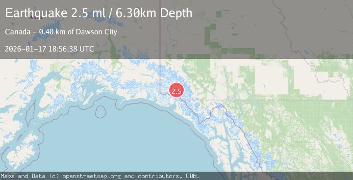
A 2.5 magnitude earthquake struck on SOUTHERN YUKON TERRITORY, CANADA, at Sat, 17 Jan 2026 18:56:38 GMT. Depth: 6.3km. Reviewed by NEIC seismologists, this minor quake occurred at a magnitude type of ml.
Magnitude
2.5
ml
Source
NEIC
Intensity
-
Agency Reports
1 Sources| Source | Magnitude | Depth | Time |
|---|---|---|---|
| NEICPrimary | 2.5 | 6 km | 1 month ago |
Earthquake Details
AutomaticEvent IDemsc_NEIC_20260117_0000320
Tsunami PotentialNo
Magnitude Typeml
Nearest Places
- Hubbard Glacier12.3 km
- St. Elias Mountains12.5 km
- Mount Vancouver14.2 km
- Hubbard Glacier15.4 km
- Mount King George19.0 km
Comments
Join the discussion about this event.
Latest Earthquakes
3.6Mag
Fox Islands, Aleutian Islands, Alaska
Time2 minutes ago
Depth28.81 km
SourceVYT (Automatic)
1.3Mag
Washington
Time3 minutes ago
Depth0.00 km
SourceVYT (Automatic)
2.0Mag
Antofagasta, Chile
Time4 minutes ago
Depth28.32 km
SourceVYT (Automatic)
1.2Mag
Central Alaska
Time5 minutes ago
Depth0.00 km
SourceVYT (Automatic)
2.1Mag
Sulawesi, Indonesia
Time6 minutes ago
Depth7.10 km
SourceBMKG
Nearby Earthquakes
3.8Mag
SOUTHERN YUKON TERRITORY, CANADA
Time1 month ago
Depth5.00 km
SourceAK (Automatic)
3.1Mag
SOUTHERN YUKON TERRITORY, CANADA
Time1 month ago
Depth5.00 km
SourceNEIC (Automatic)
3.7Mag
SOUTHERN YUKON TERRITORY, CANADA
Time2 weeks ago
Depth5.00 km
SourceNEIC (Automatic)
1.8Mag
100 km N of Yakutat, Alaska
Time1 week ago
Depth1.00 km
SourceUSGS
2.9Mag
SOUTHERN YUKON TERRITORY, CANADA
Time1 month ago
Depth5.00 km
SourceNEIC (Automatic)