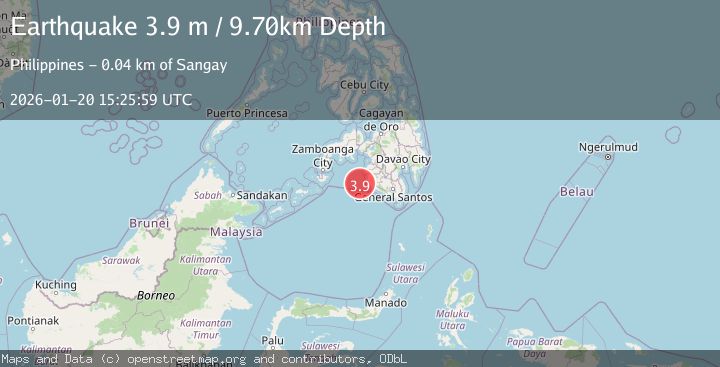
Earthquake MORO GULF, MINDANAO, PHILIPPINES
Tue, 20 Jan 2026 15:25:59 GMT
Time1 month ago
Location
6.3190, 123.7375
Depth
9.7 KM
Event Summary
A 3.9 magnitude earthquake struck on MORO GULF, MINDANAO, PHILIPPINES, at Tue, 20 Jan 2026 15:25:59 GMT. Depth: 9.7km. Reviewed by NEIC seismologists, this minor quake occurred at a magnitude type of m.
Magnitude
3.9
m
Source
NEIC
Intensity
-
Agency Reports
2 Sources| Source | Magnitude | Depth | Time |
|---|---|---|---|
| NEICPrimary | 3.9 | 10 km | 1 month ago |
| PIVS | 3.0 | 6 km | 1 month ago |
Earthquake Details
AutomaticEvent IDemsc_NEIC_20260120_0000243
Tsunami PotentialNo
Magnitude Typem
Nearest Places
- 35.1 km
- 35.1 km
- 35.7 km
- 35.7 km
- 35.8 km
Comments
Join the discussion about this event.
Latest Earthquakes
3.0Mag
Tarapaca, Chile
Time5 minutes ago
Depth111.57 km
SourceVYT (Automatic)
0.8Mag
Southern Alaska
Time7 minutes ago
Depth5.00 km
SourceVYT (Automatic)
2.1Mag
Sweden
Time13 minutes ago
Depth0.00 km
SourceVYT (Automatic)
1.6Mag
western Texas
Time13 minutes ago
Depth0.00 km
SourceVYT (Automatic)
2.8Mag
Java, Indonesia
Time14 minutes ago
Depth26.25 km
SourceVYT (Automatic)
Nearby Earthquakes
3.5Mag
MORO GULF, MINDANAO, PHILIPPINES
Time3 weeks ago
Depth10.00 km
SourceNEIC (Automatic)
4.3Mag
Mindanao, Philippines
Time3 weeks ago
Depth116.84 km
SourceBMKG (Automatic)
3.0Mag
MORO GULF, MINDANAO, PHILIPPINES
Time1 month ago
Depth24.00 km
SourcePIVS (Automatic)
3.7Mag
MORO GULF, MINDANAO, PHILIPPINES
Time3 weeks ago
Depth10.00 km
SourceNEIC (Automatic)
4.6Mag
MORO GULF, MINDANAO, PHILIPPINES
Time3 weeks ago
Depth16.00 km
SourcePIVS (Automatic)