Earthquake MORO GULF, MINDANAO, PHILIPPINES
Sun, 01 Feb 2026 06:55:19 GMT
Time3 days ago
Location
6.3400, 123.7500
Depth
16.0 KM
Event Summary
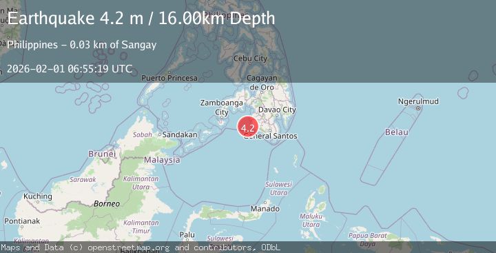
A 4.2 magnitude earthquake struck on MORO GULF, MINDANAO, PHILIPPINES, at Sun, 01 Feb 2026 06:55:19 GMT. Depth: 16km. Reviewed by PIVS seismologists, this light quake occurred at a magnitude type of m.
Magnitude
4.2
m
Source
PIVS
Intensity
-
Agency Reports
1 Sources| Source | Magnitude | Depth | Time |
|---|---|---|---|
| PIVSPrimary | 4.2 | 16 km | 3 days ago |
Earthquake Details
AutomaticEvent IDemsc_PIVS_20260201_0000089
Tsunami PotentialNo
Magnitude Typem
Nearest Places
- Donauang Island32.9 km
- Sangay Point33.0 km
- Donaung Shoals33.2 km
- Danawan Point33.7 km
- Sugco33.7 km
Comments
Join the discussion about this event.
Latest Earthquakes
2.5Mag
MONTENEGRO
Time7 minutes ago
Depth5.00 km
SourceBEO (Automatic)
1.6Mag
20 km ESE of Wofford Heights, CA
Time8 minutes ago
Depth9.94 km
SourceUSGS (Automatic)
2.1Mag
41 km ESE of Denali National Park, Alaska
Time8 minutes ago
Depth4.30 km
SourceUSGS (Automatic)
1.2Mag
SWITZERLAND
Time12 minutes ago
Depth6.30 km
SourceETHZ (Automatic)
4.0Mag
Southern Sumatra, Indonesia
Time21 minutes ago
Depth32.30 km
SourceBMKG (Automatic)
Nearby Earthquakes
5.4Mag
32 km WSW of Sangay, Philippines
Time2 weeks ago
Depth8.76 km
SourceUSGS
3.0Mag
MORO GULF, MINDANAO, PHILIPPINES
Time2 weeks ago
Depth24.00 km
SourcePIVS (Automatic)
5.4Mag
Mindanao, Philippines
Time1 week ago
Depth10.00 km
SourceBMKG (Automatic)
3.1Mag
MORO GULF, MINDANAO, PHILIPPINES
Time1 week ago
Depth20.00 km
SourcePIVS (Automatic)
4.3Mag
Mindanao, Philippines
Time1 week ago
Depth116.84 km
SourceBMKG (Automatic)