Earthquake MORO GULF, MINDANAO, PHILIPPINES
Wed, 28 Jan 2026 08:35:21 GMT
Time3 weeks ago
Location
6.3923, 123.6213
Depth
10.0 KM
Event Summary
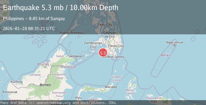
A 5.3 magnitude earthquake struck on MORO GULF, MINDANAO, PHILIPPINES, at Wed, 28 Jan 2026 08:35:21 GMT. Depth: 10km. Reviewed by NEIC seismologists, this moderate quake occurred at a magnitude type of mb.
Magnitude
5.3
mb
Source
NEIC
Intensity
-
Agency Reports
1 Sources| Source | Magnitude | Depth | Time |
|---|---|---|---|
| NEICPrimary | 5.3 | 10 km | 3 weeks ago |
Earthquake Details
AutomaticEvent IDemsc_NEIC_20260128_0000472
Tsunami PotentialNo
Magnitude Typemb
Nearest Places
- 42.9 km
- 45.0 km
- 45.8 km
- 45.8 km
- 46.0 km
Comments
Join the discussion about this event.
Latest Earthquakes
2.4Mag
Fox Islands, Aleutian Islands, Alaska
Time2 minutes ago
Depth0.00 km
SourceVYT (Automatic)
1.0Mag
4 km W of Cobb, CA
Time5 minutes ago
Depth2.31 km
SourceUSGS (Automatic)
2.4Mag
Antofagasta, Chile
Time5 minutes ago
Depth77.15 km
SourceVYT (Automatic)
2.5Mag
offshore Valparaiso, Chile
Time9 minutes ago
Depth20.02 km
SourceVYT (Automatic)
0.7Mag
2 km WNW of The Geysers, CA
Time12 minutes ago
Depth4.89 km
SourceUSGS (Automatic)
Nearby Earthquakes
3.3Mag
MORO GULF, MINDANAO, PHILIPPINES
Time1 month ago
Depth2.00 km
SourcePIVS (Automatic)
3.3Mag
MORO GULF, MINDANAO, PHILIPPINES
Time1 month ago
Depth13.00 km
SourcePIVS (Automatic)
3.1Mag
MORO GULF, MINDANAO, PHILIPPINES
Time1 month ago
Depth9.00 km
SourcePIVS (Automatic)
3.3Mag
MORO GULF, MINDANAO, PHILIPPINES
Time1 month ago
Depth4.00 km
SourcePIVS (Automatic)
3.4Mag
MORO GULF, MINDANAO, PHILIPPINES
Time4 days ago
Depth17.00 km
SourcePIVS (Automatic)