Earthquake VISAYAN SEA, PHILIPPINES
Wed, 04 Feb 2026 13:14:48 GMT
Time1 hour ago
Location
11.9113, 123.7533
Depth
10.0 KM
Event Summary
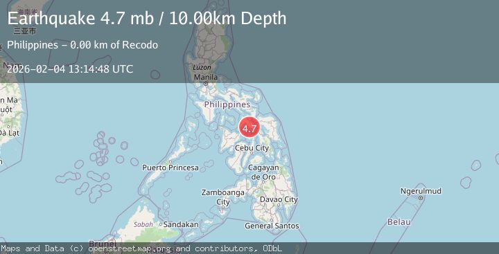
A 4.7 magnitude earthquake struck on VISAYAN SEA, PHILIPPINES, at Wed, 04 Feb 2026 13:14:48 GMT. Depth: 10km. Reviewed by NEIC seismologists, this light quake occurred at a magnitude type of mb.
Magnitude
4.7
mb
Source
NEIC
Intensity
-
Agency Reports
1 Sources| Source | Magnitude | Depth | Time |
|---|---|---|---|
| NEICPrimary | 4.7 | 10 km | 1 hour ago |
Earthquake Details
AutomaticEvent IDemsc_NEIC_20260204_0000183
Tsunami PotentialNo
Magnitude Typemb
Nearest Places
- Vigia River1.5 km
- Mahayahay1.6 km
- Cawayan River2.2 km
- Cawayan2.5 km
- Bungalon Point3.3 km
Comments
Join the discussion about this event.
Latest Earthquakes
2.0Mag
18 km WSW of Johannesburg, CA
Time1 hour ago
Depth4.58 km
SourceUSGS (Automatic)
1.5Mag
18 km N of Indio, CA
Time1 hour ago
Depth9.27 km
SourceUSGS (Automatic)
1.3Mag
4 km SE of San Ramon, CA
Time1 hour ago
Depth7.43 km
SourceUSGS (Automatic)
1.8Mag
25 km W of Garden City, Texas
Time1 hour ago
Depth7.72 km
SourceUSGS (Automatic)
1.4Mag
26 km NW of Ocotillo, CA
Time1 hour ago
Depth10.03 km
SourceUSGS (Automatic)
Nearby Earthquakes
3.4Mag
NEGROS- CEBU REG, PHILIPPINES
Time1 week ago
Depth10.00 km
SourcePIVS (Automatic)
3.2Mag
NEGROS- CEBU REG, PHILIPPINES
Time5 days ago
Depth10.00 km
SourcePIVS (Automatic)
3.0Mag
NEGROS- CEBU REG, PHILIPPINES
Time5 days ago
Depth2.00 km
SourcePIVS (Automatic)
3.8Mag
NEGROS- CEBU REG, PHILIPPINES
Time4 days ago
Depth9.00 km
SourcePIVS (Automatic)
3.1Mag
MASBATE REGION, PHILIPPINES
Time1 week ago
Depth9.00 km
SourcePIVS (Automatic)