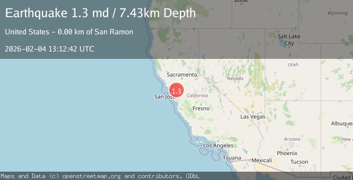
Earthquake 4 km SE of San Ramon, CA
Wed, 04 Feb 2026 13:12:42 GMT
Time1 hour ago
Location
37.7568, -121.9485
Depth
7.4 KM
Event Summary
A 1.3 magnitude earthquake struck on 4 km SE of San Ramon, CA, at Wed, 04 Feb 2026 13:12:42 GMT. Depth: 7.42999982833862km. Reviewed by USGS seismologists, this minor quake occurred at a magnitude type of md.
Magnitude
1.3
md
Source
USGS
Intensity
-
Agency Reports
1 Sources| Source | Magnitude | Depth | Time |
|---|---|---|---|
| USGSPrimary | 1.3 | 7 km | 1 hour ago |
Earthquake Details
AutomaticEvent IDusgs_nc75308282
Tsunami PotentialNo
Magnitude Typemd
Nearest Places
- Montevideo Elementary School0.2 km
- Coyote Creek0.2 km
- San Ramon Library0.4 km
- Oakwood San Ramon0.6 km
- San Ramon Village Shopping Center0.8 km
Comments
Join the discussion about this event.
Latest Earthquakes
1.3Mag
26 km NW of Ocotillo, CA
Time4 minutes ago
Depth10.06 km
SourceUSGS (Automatic)
3.5Mag
OFF E. COAST OF N. ISLAND, N.Z.
Time16 minutes ago
Depth243.20 km
SourceGNS (Automatic)
3.1Mag
South of Sumbawa, Indonesia
Time22 minutes ago
Depth37.44 km
SourceBMKG (Automatic)
3.0Mag
Northern Sumatra, Indonesia
Time26 minutes ago
Depth3.00 km
SourceBMKG (Automatic)
2.2Mag
62 km W of Tyonek, Alaska
Time29 minutes ago
Depth113.70 km
SourceUSGS (Automatic)
Nearby Earthquakes
3.4Mag
4 km SE of San Ramon, CA
Time1 day ago
Depth1.17 km
SourceUSGS (Automatic)
2.2Mag
4 km SE of San Ramon, CA
Time1 day ago
Depth6.96 km
SourceUSGS (Automatic)
1.3Mag
3 km SE of San Ramon, CA
Time22 hours ago
Depth4.70 km
SourceUSGS (Automatic)
3.7Mag
SAN FRANCISCO BAY AREA, CALIF.
Time2 days ago
Depth9.50 km
SourceNC (Automatic)
2.4Mag
4 km SE of San Ramon, CA
Time1 day ago
Depth7.40 km
SourceUSGS (Automatic)