Earthquake SOUTHERN ALASKA
Sat, 12 Apr 2014 23:11:51 GMT
Time11 years ago
Location
59.1400, -152.5300
Depth
73.0 KM
Event Summary
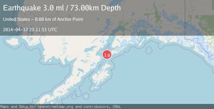
A 3.0 magnitude earthquake struck on SOUTHERN ALASKA, at Sat, 12 Apr 2014 23:11:51 GMT. Depth: 73km. Reviewed by NEIR seismologists, this minor quake occurred at a magnitude type of ml.
Magnitude
3.0
ml
Source
NEIR
Intensity
-
Agency Reports
1 Sources| Source | Magnitude | Depth | Time |
|---|---|---|---|
| NEIRPrimary | 3.0 | 73 km | 11 years ago |
Earthquake Details
AutomaticEvent IDemsc_NEIR_20140412_0000118
Tsunami PotentialNo
Magnitude Typeml
Nearest Places
- Cook Inlet21.3 km
- Northwest Point23.1 km
- Ushagat Island28.3 km
- Nord Island28.8 km
- Table Mountain30.0 km
Comments
Join the discussion about this event.
Latest Earthquakes
3.0Mag
Java, Indonesia
Time3 minutes ago
Depth29.78 km
SourceBMKG
2.4Mag
Finland-Russia border region
Time4 minutes ago
Depth341.92 km
SourceVYT (Automatic)
0.9Mag
8 km W of Cobb, CA
Time8 minutes ago
Depth1.53 km
SourceUSGS (Automatic)
1.8Mag
Central Alaska
Time11 minutes ago
Depth2.08 km
SourceVYT (Automatic)
2.9Mag
WESTERN TURKEY
Time14 minutes ago
Depth11.80 km
SourceKOERI (Automatic)
Nearby Earthquakes
2.9Mag
SOUTHERN ALASKA
Time2 months ago
Depth65.10 km
SourceNEIC (Automatic)
2.9Mag
SOUTHERN ALASKA
Time1 month ago
Depth65.00 km
SourceNEIC (Automatic)
1.9Mag
Southern Alaska
Time1 week ago
Depth71.29 km
SourceVYT (Automatic)
3.0Mag
SOUTHERN ALASKA
Time3 years ago
Depth69.00 km
SourceNEIC (Automatic)
3.0Mag
SOUTHERN ALASKA
Time11 years ago
Depth80.00 km
SourceNEIC (Automatic)