Earthquake SOUTHERN CALIFORNIA
Mon, 07 Jul 2014 08:51:05 GMT
Time11 years ago
Location
34.2800, -117.0300
Depth
9.0 KM
Event Summary
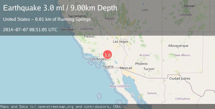
A 3.0 magnitude earthquake struck on SOUTHERN CALIFORNIA, at Mon, 07 Jul 2014 08:51:05 GMT. Depth: 9km. Reviewed by NEIR seismologists, this minor quake occurred at a magnitude type of ml.
Magnitude
3.0
ml
Source
NEIR
Intensity
-
Agency Reports
1 Sources| Source | Magnitude | Depth | Time |
|---|---|---|---|
| NEIRPrimary | 3.0 | 9 km | 11 years ago |
Earthquake Details
AutomaticEvent IDemsc_NEIR_20140707_0000020
Tsunami PotentialNo
Magnitude Typeml
Nearest Places
- Lower Larga Flat1.0 km
- Lightning Spring1.9 km
- West Point2.3 km
- Cienega Spring2.3 km
- Snow Slide Spring2.4 km
Comments
Join the discussion about this event.
Latest Earthquakes
2.2Mag
West Papua Region, Indonesia
Time2 minutes ago
Depth10.00 km
SourceBMKG
2.2Mag
Kenai Peninsula, Alaska
Time4 minutes ago
Depth47.00 km
SourceVYT (Automatic)
2.0Mag
Antofagasta, Chile
Time10 minutes ago
Depth23.32 km
SourceVYT (Automatic)
2.8Mag
Queensland, Australia
Time11 minutes ago
Depth714.23 km
SourceVYT (Automatic)
1.1Mag
5 km S of Salcha, Alaska
Time16 minutes ago
Depth8.70 km
SourceUSGS (Automatic)
Nearby Earthquakes
3.0Mag
SOUTHERN CALIFORNIA
Time11 years ago
Depth13.00 km
SourceCI (Automatic)
1.9Mag
Southern California
Time5 days ago
Depth13.79 km
SourceVYT (Automatic)
2.8Mag
Southern California
Time5 days ago
Depth12.57 km
SourceVYT (Automatic)
1.7Mag
Southern California
Time5 days ago
Depth16.72 km
SourceVYT (Automatic)
2.6Mag
SOUTHERN CALIFORNIA
Time1 month ago
Depth6.80 km
SourceSCSN (Automatic)