Earthquake West Papua Region, Indonesia
Fri, 20 Feb 2026 17:10:37 GMT
Time1 hour ago
Location
-1.2885, 133.6946
Depth
10.0 KM
Event Summary
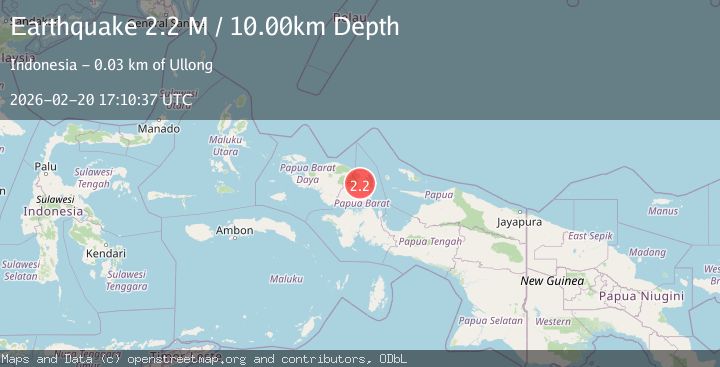
A 2.2 magnitude earthquake struck on West Papua Region, Indonesia, at Fri, 20 Feb 2026 17:10:37 GMT. Depth: 10km. Reviewed by BMKG seismologists, this minor quake occurred at a magnitude type of M.
Magnitude
2.2
M
Source
BMKG
Intensity
-
Agency Reports
1 Sources| Source | Magnitude | Depth | Time |
|---|---|---|---|
| BMKGPrimary | 2.2 | 10 km | 1 hour ago |
Earthquake Details
ManualEvent IDbmg2026dord
Tsunami PotentialNo
Magnitude TypeM
Nearest Places
- Distrik Didohu0.6 km
- Kampung Sugemeh4.7 km
- Tiraga7.1 km
- Kampung Ijigreg7.2 km
- Kampung Danmou7.5 km
Comments
Join the discussion about this event.
Latest Earthquakes
2.1Mag
Kenai Peninsula, Alaska
Time1 hour ago
Depth47.00 km
SourceVYT (Automatic)
2.0Mag
Antofagasta, Chile
Time1 hour ago
Depth23.32 km
SourceVYT (Automatic)
2.8Mag
Queensland, Australia
Time1 hour ago
Depth714.23 km
SourceVYT (Automatic)
1.1Mag
5 km S of Salcha, Alaska
Time1 hour ago
Depth8.70 km
SourceUSGS (Automatic)
1.4Mag
CENTRAL TURKEY
Time1 hour ago
Depth7.20 km
SourceAFAD (Automatic)
Nearby Earthquakes
2.1Mag
West Papua Region, Indonesia
Time0 months ago
Depth38.83 km
SourceBMKG (Automatic)
3.0Mag
PAPUA, INDONESIA
Time11 months ago
Depth10.00 km
SourceBMKG (Automatic)
4.5Mag
West Papua Region, Indonesia
Time2 weeks ago
Depth20.81 km
SourceBMKG (Automatic)
3.0Mag
PAPUA, INDONESIA
Time3 years ago
Depth10.00 km
SourceDJA (Automatic)
2.4Mag
West Papua Region, Indonesia
Time2 weeks ago
Depth9.36 km
SourceBMKG (Automatic)