Earthquake ISLAND OF HAWAII, HAWAII
Thu, 12 Feb 2015 05:46:34 GMT
Time11 years ago
Location
19.1700, -155.4600
Depth
9.0 KM
Event Summary
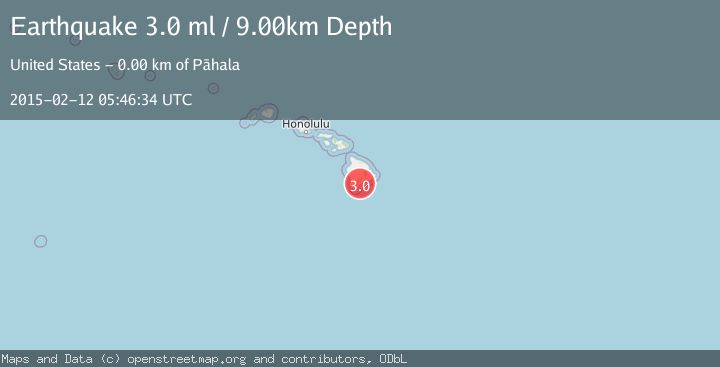
A 3.0 magnitude earthquake struck on ISLAND OF HAWAII, HAWAII, at Thu, 12 Feb 2015 05:46:34 GMT. Depth: 9km. Reviewed by NEIR seismologists, this minor quake occurred at a magnitude type of ml.
Magnitude
3.0
ml
Source
NEIR
Intensity
-
Agency Reports
1 Sources| Source | Magnitude | Depth | Time |
|---|---|---|---|
| NEIRPrimary | 3.0 | 9 km | 11 years ago |
Earthquake Details
AutomaticEvent IDemsc_NEIR_20150212_0000025
Tsunami PotentialNo
Magnitude Typeml
Nearest Places
- Hi‘onamoa Gulch1.8 km
- Cinder Hills1.9 km
- Kanenelu Flat1.9 km
- Puu Kolea2.0 km
- Moa‘ula Gulch2.2 km
Comments
Join the discussion about this event.
Latest Earthquakes
2.2Mag
Finland
Time43 seconds ago
Depth24.05 km
SourceVYT (Automatic)
2.6Mag
Central Alaska
Time57 seconds ago
Depth30.88 km
SourceVYT (Automatic)
1.0Mag
Alaska Peninsula
Time3 minutes ago
Depth0.61 km
SourceVYT (Automatic)
2.0Mag
western Texas
Time3 minutes ago
Depth0.00 km
SourceVYT (Automatic)
2.8Mag
OFFSHORE EL SALVADOR
Time6 minutes ago
Depth18.00 km
SourceINET (Automatic)
Nearby Earthquakes
2.2Mag
ISLAND OF HAWAII, HAWAII
Time2 weeks ago
Depth30.40 km
SourceHV (Automatic)
3.0Mag
ISLAND OF HAWAII, HAWAII
Time10 years ago
Depth33.00 km
SourceNEIR (Automatic)
2.8Mag
ISLAND OF HAWAII, HAWAII
Time3 days ago
Depth31.60 km
SourceHV (Automatic)
2.0Mag
ISLAND OF HAWAII, HAWAII
Time1 week ago
Depth31.50 km
SourceHV (Automatic)
2.5Mag
ISLAND OF HAWAII, HAWAII
Time1 month ago
Depth31.10 km
SourceHV (Automatic)