Earthquake SOUTHERN CALIFORNIA
Tue, 19 Jan 2016 14:34:28 GMT
Time10 years ago
Location
34.6900, -116.2400
Depth
2.0 KM
Event Summary
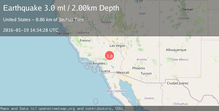
A 3.0 magnitude earthquake struck on SOUTHERN CALIFORNIA, at Tue, 19 Jan 2016 14:34:28 GMT. Depth: 2km. Reviewed by NEIR seismologists, this minor quake occurred at a magnitude type of ml.
Magnitude
3.0
ml
Source
NEIR
Intensity
-
Agency Reports
1 Sources| Source | Magnitude | Depth | Time |
|---|---|---|---|
| NEIRPrimary | 3.0 | 2 km | 10 years ago |
Earthquake Details
AutomaticEvent IDemsc_NEIR_20160119_0000070
Tsunami PotentialNo
Magnitude Typeml
Nearest Places
- Argos4.1 km
- Sand Hill6.6 km
- Lavic Mountain Mine7.9 km
- Lavic7.9 km
- Ludlow8.1 km
Comments
Join the discussion about this event.
Latest Earthquakes
1.3Mag
Kenai Peninsula, Alaska
Time10 hours ago
Depth21.00 km
SourceVYT (Automatic)
1.6Mag
Southern Alaska
Time10 hours ago
Depth84.72 km
SourceVYT (Automatic)
1.3Mag
Southern Alaska
Time10 hours ago
Depth6.47 km
SourceVYT (Automatic)
3.6Mag
Tarapaca, Chile
Time10 hours ago
Depth101.32 km
SourceVYT (Automatic)
2.8Mag
Wyoming
Time10 hours ago
Depth111.08 km
SourceVYT (Automatic)
Nearby Earthquakes
3.0Mag
SOUTHERN CALIFORNIA
Time8 years ago
Depth3.00 km
SourceNEIC (Automatic)
4.0Mag
SOUTHERN CALIFORNIA
Time7 years ago
Depth2.00 km
SourceNEIC (Automatic)
2.3Mag
SOUTHERN CALIFORNIA
Time3 weeks ago
Depth3.50 km
SourceSCSN (Automatic)
2.1Mag
SOUTHERN CALIFORNIA
Time1 month ago
Depth1.80 km
SourceSCSN (Automatic)
2.3Mag
Southern California
Time1 day ago
Depth0.00 km
SourceVYT (Automatic)