Earthquake SOUTHERN ALASKA
Wed, 28 Dec 2016 07:17:40 GMT
Time9 years ago
Location
61.7300, -149.4600
Depth
34.0 KM
Event Summary
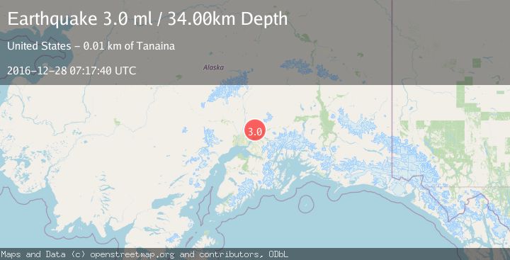
A 3.0 magnitude earthquake struck on SOUTHERN ALASKA, at Wed, 28 Dec 2016 07:17:40 GMT. Depth: 34km. Reviewed by NEIR seismologists, this minor quake occurred at a magnitude type of ml.
Magnitude
3.0
ml
Source
NEIR
Intensity
-
Agency Reports
1 Sources| Source | Magnitude | Depth | Time |
|---|---|---|---|
| NEIRPrimary | 3.0 | 34 km | 9 years ago |
Earthquake Details
AutomaticEvent IDemsc_NEIR_20161228_0000184
Tsunami PotentialNo
Magnitude Typeml
Nearest Places
- Thorpe Mine2.2 km
- West Fork2.9 km
- West Fork Grubstake Gulch2.9 km
- West Fork Grubstake Creek3.0 km
- Craigie Creek3.3 km
Comments
Join the discussion about this event.
Latest Earthquakes
2.5Mag
British Columbia, Canada
Time1 minute ago
Depth0.00 km
SourceVYT (Automatic)
3.4Mag
San Juan, Argentina
Time8 minutes ago
Depth10.00 km
SourceVYT (Automatic)
3.0Mag
Potosi, Bolivia
Time10 minutes ago
Depth269.04 km
SourceVYT (Automatic)
2.4Mag
Central Alaska
Time12 minutes ago
Depth0.24 km
SourceVYT (Automatic)
3.7Mag
Seram, Indonesia
Time12 minutes ago
Depth0.00 km
SourceVYT (Automatic)
Nearby Earthquakes
3.0Mag
SOUTHERN ALASKA
Time6 years ago
Depth31.00 km
SourceNEIC (Automatic)
4.0Mag
SOUTHERN ALASKA
Time3 years ago
Depth36.00 km
SourceNEIC (Automatic)
3.4Mag
SOUTHERN ALASKA
Time1 month ago
Depth32.20 km
SourceNEIC (Automatic)
2.3Mag
Southern Alaska
Time1 week ago
Depth37.23 km
SourceVYT (Automatic)
1.5Mag
Southern Alaska
Time1 week ago
Depth45.65 km
SourceVYT (Automatic)