Earthquake SOUTHEASTERN ALASKA
Fri, 27 Jan 2017 01:17:42 GMT
Time9 years ago
Location
59.1000, -136.3900
Depth
6.0 KM
Event Summary
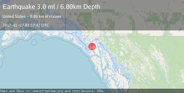
A 3.0 magnitude earthquake struck on SOUTHEASTERN ALASKA, at Fri, 27 Jan 2017 01:17:42 GMT. Depth: 6km. Reviewed by NEIR seismologists, this minor quake occurred at a magnitude type of ml.
Magnitude
3.0
ml
Source
NEIR
Intensity
-
Agency Reports
1 Sources| Source | Magnitude | Depth | Time |
|---|---|---|---|
| NEIRPrimary | 3.0 | 6 km | 9 years ago |
Earthquake Details
AutomaticEvent IDemsc_NEIR_20170127_0000004
Tsunami PotentialNo
Magnitude Typeml
Nearest Places
- Muir Glacier0.7 km
- Mount Brock7.5 km
- Morse Glacier7.8 km
- Gable Mountain9.0 km
- Cushing Glacier9.3 km
Comments
Join the discussion about this event.
Latest Earthquakes
3.0Mag
Northern Sumatra, Indonesia
Time3 minutes ago
Depth5.00 km
SourceBMKG
2.9Mag
Salta, Argentina
Time4 minutes ago
Depth296.51 km
SourceVYT (Automatic)
2.4Mag
Sumbawa Region, Indonesia
Time11 minutes ago
Depth20.31 km
SourceBMKG
1.2Mag
3 km N of The Geysers, CA
Time15 minutes ago
Depth1.73 km
SourceUSGS (Automatic)
2.2Mag
Central Alaska
Time17 minutes ago
Depth9.77 km
SourceVYT (Automatic)
Nearby Earthquakes
5.2Mag
SOUTHEASTERN ALASKA
Time2 years ago
Depth3.90 km
SourceEMSC (Automatic)
3.0Mag
SOUTHEASTERN ALASKA
Time11 months ago
Depth10.00 km
SourceNEIC (Automatic)
3.0Mag
SOUTHEASTERN ALASKA
Time2 years ago
Depth6.70 km
SourceAK (Automatic)
3.0Mag
SOUTHEASTERN ALASKA
Time8 years ago
Depth8.00 km
SourceNEIR (Automatic)
3.0Mag
SOUTHEASTERN ALASKA
Time11 years ago
Depth9.00 km
SourceNEIC (Automatic)