Earthquake ISLAND OF HAWAII, HAWAII
Fri, 17 Feb 2017 02:43:44 GMT
Time9 years ago
Location
19.1400, -155.4800
Depth
39.0 KM
Event Summary
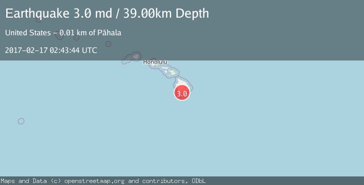
A 3.0 magnitude earthquake struck on ISLAND OF HAWAII, HAWAII, at Fri, 17 Feb 2017 02:43:44 GMT. Depth: 39km. Reviewed by NEIR seismologists, this minor quake occurred at a magnitude type of md.
Magnitude
3.0
md
Source
NEIR
Intensity
-
Agency Reports
1 Sources| Source | Magnitude | Depth | Time |
|---|---|---|---|
| NEIRPrimary | 3.0 | 39 km | 9 years ago |
Earthquake Details
AutomaticEvent IDemsc_NEIR_20170217_0000010
Tsunami PotentialNo
Magnitude Typemd
Nearest Places
- Nahuluhulu Point1.3 km
- Keone‘ele‘ele Flat1.4 km
- Mohokea Nui1.5 km
- Kamehame Beach1.6 km
- Kamehame Hill1.6 km
Comments
Join the discussion about this event.
Latest Earthquakes
1.8Mag
8 km SSW of Dayton, Nevada
Time3 minutes ago
Depth2.65 km
SourceUSGS (Automatic)
1.4Mag
6 km SSW of Idyllwild, CA
Time8 minutes ago
Depth15.02 km
SourceUSGS (Automatic)
2.4Mag
western Texas
Time10 minutes ago
Depth6.10 km
SourceVYT (Automatic)
2.8Mag
Southern Alaska
Time12 minutes ago
Depth14.04 km
SourceVYT (Automatic)
2.4Mag
Southern Alaska
Time14 minutes ago
Depth139.28 km
SourceVYT (Automatic)
Nearby Earthquakes
2.2Mag
ISLAND OF HAWAII, HAWAII
Time1 month ago
Depth30.60 km
SourceHV (Automatic)
2.1Mag
ISLAND OF HAWAII, HAWAII
Time2 weeks ago
Depth34.70 km
SourceHV (Automatic)
3.0Mag
ISLAND OF HAWAII, HAWAII
Time5 years ago
Depth50.00 km
SourceNEIC (Automatic)
2.4Mag
ISLAND OF HAWAII, HAWAII
Time2 weeks ago
Depth29.90 km
SourceHV (Automatic)
2.5Mag
ISLAND OF HAWAII, HAWAII
Time1 month ago
Depth31.10 km
SourceHV (Automatic)