Earthquake KENAI PENINSULA, ALASKA
Sun, 26 Feb 2017 17:20:05 GMT
Time8 years ago
Location
59.9000, -148.0600
Depth
8.0 KM
Event Summary
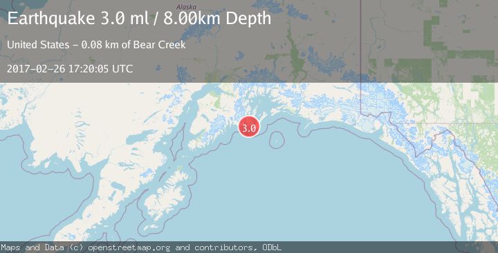
A 3.0 magnitude earthquake struck on KENAI PENINSULA, ALASKA, at Sun, 26 Feb 2017 17:20:05 GMT. Depth: 8km. Reviewed by NEIR seismologists, this minor quake occurred at a magnitude type of ml.
Magnitude
3.0
ml
Source
NEIR
Intensity
-
Agency Reports
1 Sources| Source | Magnitude | Depth | Time |
|---|---|---|---|
| NEIRPrimary | 3.0 | 8 km | 8 years ago |
Earthquake Details
AutomaticEvent IDemsc_NEIR_20170226_0000092
Tsunami PotentialNo
Magnitude Typeml
Nearest Places
- Danger Island3.1 km
- Elrington Island8.4 km
- Fox Farm Bay9.2 km
- Montgomery Bay9.3 km
- South Twin Bay9.3 km
Comments
Join the discussion about this event.
Latest Earthquakes
2.0Mag
Tarapaca, Chile
Time18 hours ago
Depth9.28 km
SourceVYT (Automatic)
0.6Mag
10 km NW of The Geysers, CA
Time18 hours ago
Depth1.32 km
SourceUSGS (Automatic)
3.8Mag
northern Colombia
Time18 hours ago
Depth301.88 km
SourceVYT (Automatic)
0.9Mag
8 km W of Cobb, CA
Time18 hours ago
Depth1.18 km
SourceUSGS (Automatic)
2.2Mag
31 km SE of Funny River, Alaska
Time18 hours ago
Depth33.00 km
SourceUSGS (Automatic)
Nearby Earthquakes
3.0Mag
KENAI PENINSULA, ALASKA
Time5 years ago
Depth26.00 km
SourceNEIR (Automatic)
2.1Mag
Southern Alaska
Time4 days ago
Depth5.98 km
SourceVYT (Automatic)
3.0Mag
GULF OF ALASKA
Time4 years ago
Depth25.00 km
SourceNEIC (Automatic)
2.5Mag
SOUTHERN ALASKA
Time1 month ago
Depth20.90 km
SourceNEIC (Automatic)
2.5Mag
SOUTHERN ALASKA
Time1 month ago
Depth25.00 km
SourceNEIC (Automatic)