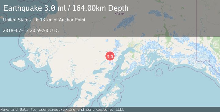
Earthquake SOUTHERN ALASKA
Thu, 12 Jul 2018 20:59:50 GMT
Time7 years ago
Location
60.6400, -153.3800
Depth
164.0 KM
Event Summary
A 3.0 magnitude earthquake struck on SOUTHERN ALASKA, at Thu, 12 Jul 2018 20:59:50 GMT. Depth: 164km. Reviewed by NEIR seismologists, this minor quake occurred at a magnitude type of ml.
Magnitude
3.0
ml
Source
NEIR
Intensity
-
Agency Reports
1 Sources| Source | Magnitude | Depth | Time |
|---|---|---|---|
| NEIRPrimary | 3.0 | 164 km | 7 years ago |
Earthquake Details
AutomaticEvent IDemsc_NEIR_20180712_0000531
Tsunami PotentialNo
Magnitude Typeml
Nearest Places
- Lake Clark Wilderness2.2 km
- Moose Pasture Pass6.6 km
- Lake Clark National Park12.6 km
- North Fork Tlikakila River13.3 km
- Richard Proenneke Site24.0 km
Comments
Join the discussion about this event.
Latest Earthquakes
1.4Mag
EASTERN TURKEY
Time8 minutes ago
Depth6.80 km
SourceAFAD (Automatic)
1.7Mag
northern Alaska
Time9 minutes ago
Depth4.64 km
SourceVYT (Automatic)
1.2Mag
5 km WNW of The Geysers, CA
Time14 minutes ago
Depth3.19 km
SourceUSGS (Automatic)
3.4Mag
Sulawesi, Indonesia
Time18 minutes ago
Depth27.95 km
SourceVYT (Automatic)
1.6Mag
Central Alaska
Time19 minutes ago
Depth18.07 km
SourceVYT (Automatic)
Nearby Earthquakes
1.4Mag
Southern Alaska
Time1 week ago
Depth14.16 km
SourceVYT (Automatic)
2.7Mag
Southern Alaska
Time3 days ago
Depth169.43 km
SourceVYT (Automatic)
3.0Mag
SOUTHERN ALASKA
Time9 years ago
Depth135.00 km
SourceNEIC (Automatic)
3.0Mag
SOUTHERN ALASKA
Time4 years ago
Depth140.00 km
SourceNEIC (Automatic)
1.2Mag
Southern Alaska
Time5 days ago
Depth7.81 km
SourceVYT (Automatic)