Earthquake HAWAII REGION, HAWAII
Fri, 28 Sep 2018 10:05:05 GMT
Time7 years ago
Location
20.1400, -155.7900
Depth
22.0 KM
Event Summary
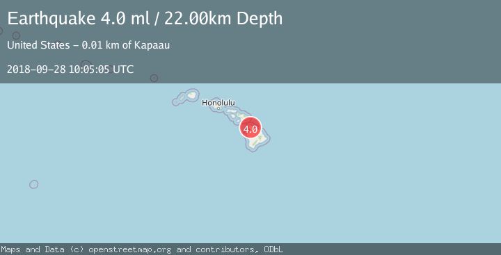
A 4.0 magnitude earthquake struck on HAWAII REGION, HAWAII, at Fri, 28 Sep 2018 10:05:05 GMT. Depth: 22km. Reviewed by NEIR seismologists, this light quake occurred at a magnitude type of ml.
Magnitude
4.0
ml
Source
NEIR
Intensity
-
Agency Reports
1 Sources| Source | Magnitude | Depth | Time |
|---|---|---|---|
| NEIRPrimary | 4.0 | 22 km | 7 years ago |
Earthquake Details
AutomaticEvent IDemsc_NEIR_20180928_0000044
Tsunami PotentialNo
Magnitude Typeml
Nearest Places
- Kahua One0.2 km
- Puu Oo0.2 km
- Puu Maile0.5 km
- North Kohala1.0 km
- Kahua Ditch1.0 km
Comments
Join the discussion about this event.
Latest Earthquakes
2.9Mag
Seram, Indonesia
Time6 hours ago
Depth15.78 km
SourceBMKG
2.2Mag
Java, Indonesia
Time6 hours ago
Depth115.38 km
SourceBMKG
1.4Mag
7 km NW of The Geysers, CA
Time6 hours ago
Depth1.65 km
SourceUSGS (Automatic)
1.1Mag
7 km NE of San Jacinto, CA
Time6 hours ago
Depth16.11 km
SourceUSGS (Automatic)
1.4Mag
CENTRAL TURKEY
Time6 hours ago
Depth7.00 km
SourceAFAD (Automatic)
Nearby Earthquakes
3.0Mag
HAWAII REGION, HAWAII
Time1 year ago
Depth23.50 km
SourceHV (Automatic)
3.0Mag
HAWAII REGION, HAWAII
Time7 years ago
Depth12.00 km
SourceNEIR (Automatic)
3.0Mag
HAWAII REGION, HAWAII
Time4 months ago
Depth35.00 km
SourceNEIC (Automatic)
1.8Mag
11 km NW of Waimea, Hawaii
Time2 weeks ago
Depth14.38 km
SourceUSGS (Automatic)
3.0Mag
HAWAII REGION, HAWAII
Time1 year ago
Depth99.50 km
SourceHV (Automatic)