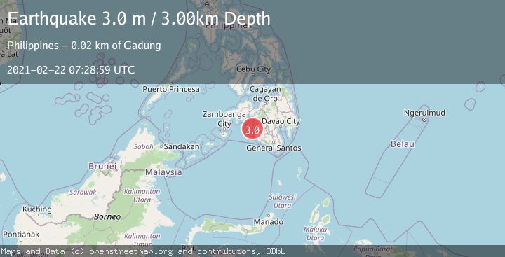
Earthquake MORO GULF, MINDANAO, PHILIPPINES
Mon, 22 Feb 2021 07:28:59 GMT
Time4 years ago
Location
6.9600, 123.8700
Depth
3.0 KM
Event Summary
A 3.0 magnitude earthquake struck on MORO GULF, MINDANAO, PHILIPPINES, at Mon, 22 Feb 2021 07:28:59 GMT. Depth: 3km. Reviewed by PIVS seismologists, this minor quake occurred at a magnitude type of m.
Magnitude
3.0
m
Source
PIVS
Intensity
-
Agency Reports
1 Sources| Source | Magnitude | Depth | Time |
|---|---|---|---|
| PIVSPrimary | 3.0 | 3 km | 4 years ago |
Earthquake Details
AutomaticEvent IDemsc_PIVS_20210222_0000035
Tsunami PotentialNo
Magnitude Typem
Nearest Places
- Lugong Point11.1 km
- Lupot Point11.1 km
- Landasan Point11.1 km
- Tambak-kinimi Beach11.3 km
- Tambak11.4 km
Comments
Join the discussion about this event.
Latest Earthquakes
2.3Mag
Poland
Time7 hours ago
Depth0.49 km
SourceVYT (Automatic)
1.7Mag
Java, Indonesia
Time7 hours ago
Depth5.98 km
SourceVYT (Automatic)
2.5Mag
SPAIN
Time7 hours ago
Depth2.90 km
SourceIGN (Automatic)
2.5Mag
West Papua Region, Indonesia
Time7 hours ago
Depth12.37 km
SourceBMKG
2.6Mag
Antofagasta, Chile
Time7 hours ago
Depth116.33 km
SourceVYT (Automatic)
Nearby Earthquakes
5.8Mag
MORO GULF, MINDANAO, PHILIPPINES
Time3 years ago
Depth20.00 km
SourceEMSC (Automatic)
5.9Mag
MORO GULF, MINDANAO, PHILIPPINES
Time7 years ago
Depth552.00 km
SourceEMSC (Automatic)
6.0Mag
MORO GULF, MINDANAO, PHILIPPINES
Time15 years ago
Depth10.00 km
SourceEMSC (Automatic)
3.0Mag
MORO GULF, MINDANAO, PHILIPPINES
Time2 years ago
Depth8.00 km
SourcePIVS (Automatic)
5.0Mag
MORO GULF, MINDANAO, PHILIPPINES
Time7 years ago
Depth10.00 km
SourceDJA (Automatic)